Snow moves in overnight; dangerous travel likely into midweek
Accumulating snow likely through Wednesday and Thursday
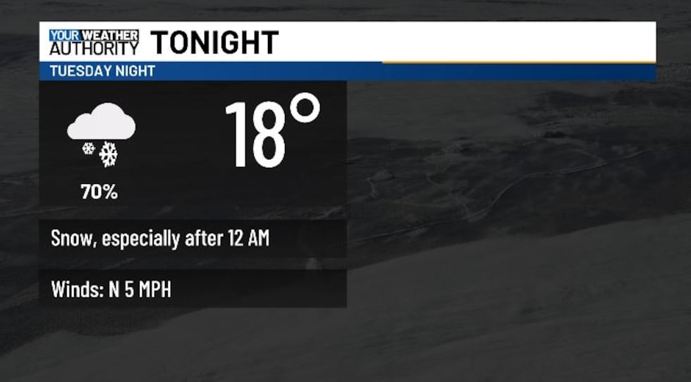
BLUEFIELD, W.Va. (WVVA) - Tonight, temps will hit the 20s and teens, and snow will develop, mainly after midnight and well into Wednesday AM. Slick roads will be likely overnight, and into early Wednesday as snow grows steadier, heavier, and wider-spread.
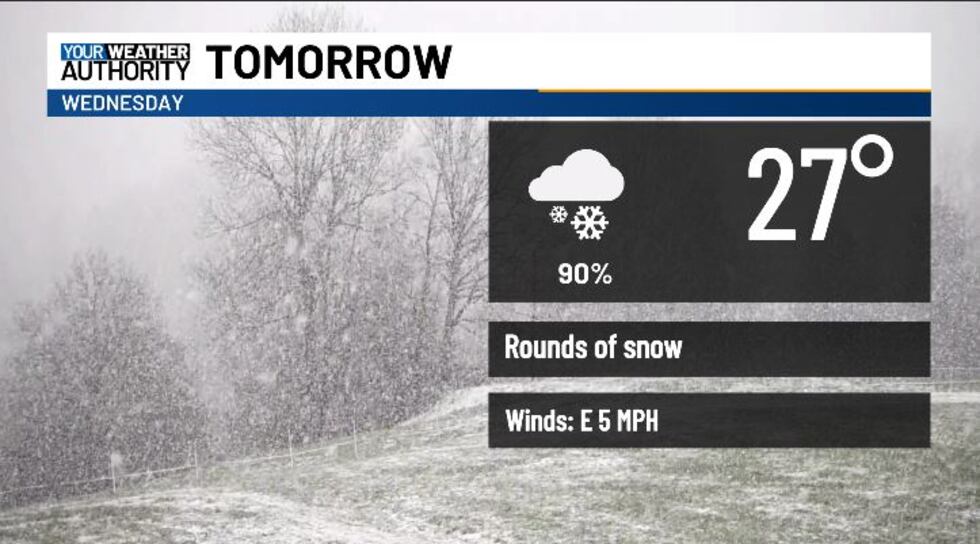
Tomorrow, snow will be on and off, become more scattered/spotty by the afternoon. High temps will stay below normal, and below freezing for many, in the 20s and low 30s on Wednesday.
Wednesday night we’ll see a few more snow showers and low temps in the single digits and low teens.
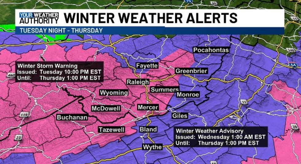
A WINTER STORM WARNING WILL BE IN EFFECT TONIGHT FOR SE FAYETTE, WESTERN GREENBRIER, RALEIGH, WYOMING, MCDOWELL, BUCHANAN, TAZEWELL, MERCER, AND SUMMERS COUNTIES.
A WINTER WEATHER ADVISORY WILL BE IN EFFECT FOR GILES, BLAND, WYTHE, MONROE, EASTERN GREENBRIER, AND POCAHONTAS COUNTIES.
Most of our western slopes (warned areas) will receive 4-8″ of snow tonight-Thursday. Eastern side still looks to get 2-4″ (advisoried areas).

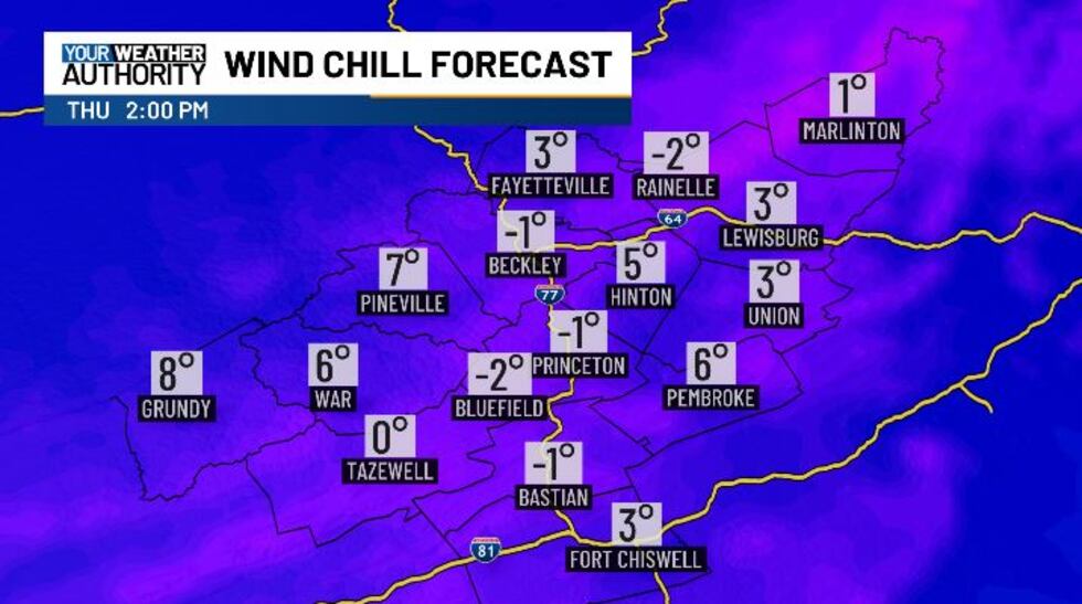
More snow will be likely across our western slopes in particular on Thursday. We’ll stay bitter cold into late week, with highs only in the teens. Wind chills will likely be in the single digits or below zero through the day Thursday. Thursday night, we will fall into the single digits, with wind chills again below zero likely through Friday AM.
We should be warming back up as we head toward the weekend...but snowmelt could aggravate flood clean-up....
STAY TUNED!
Copyright 2025 WVVA. All rights reserved.


