Summer-like weather arrives as we close the door on the last day of winter
We’ll feel more like mid-June this afternoon.
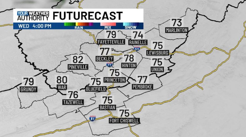
This morning’s temperatures are wide ranging, with 30s, 40s, and 50s around the area. We will be starting off warm, and warming up nicely into the late morning, hitting the mid 50s by 10 AM. Partly cloudy skies are on tap, but we’ll still warm up into the mid 70s heading into the afternoon. Some parts of our area to the west could get into the 80s later today. Tonight will be warm, with lows down in the low 50s.
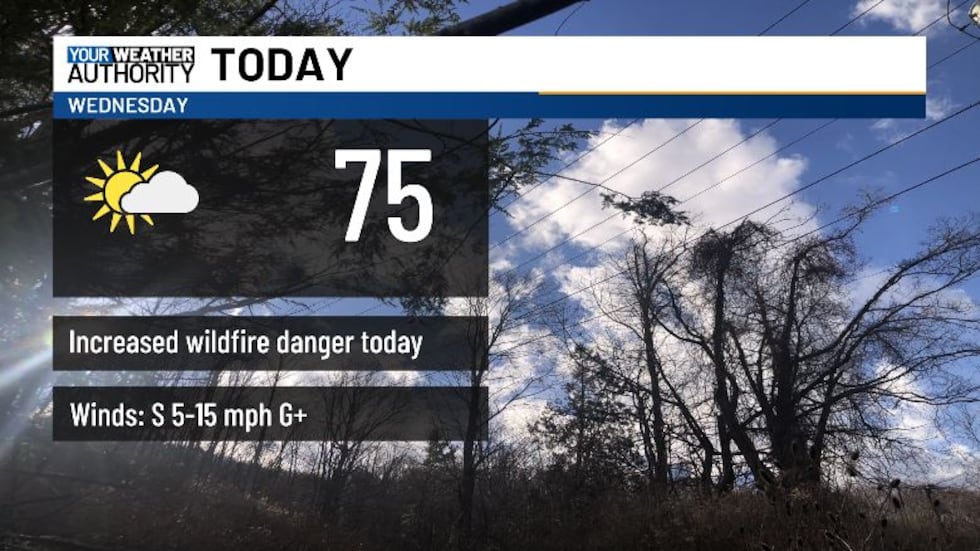
Today will also be breezy, with sustained winds out of the west at 5-15 mph. Wind gusts of up to 25 mph or more will be possible today, with gustier winds tomorrow with the passage of a cold front, switching to the west.
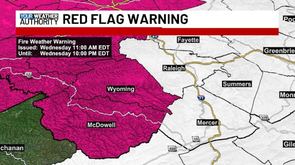
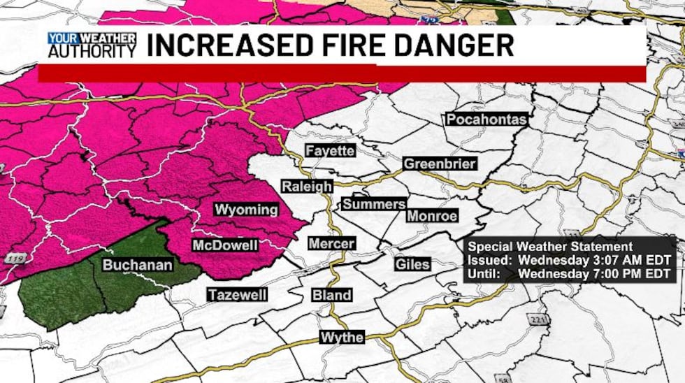
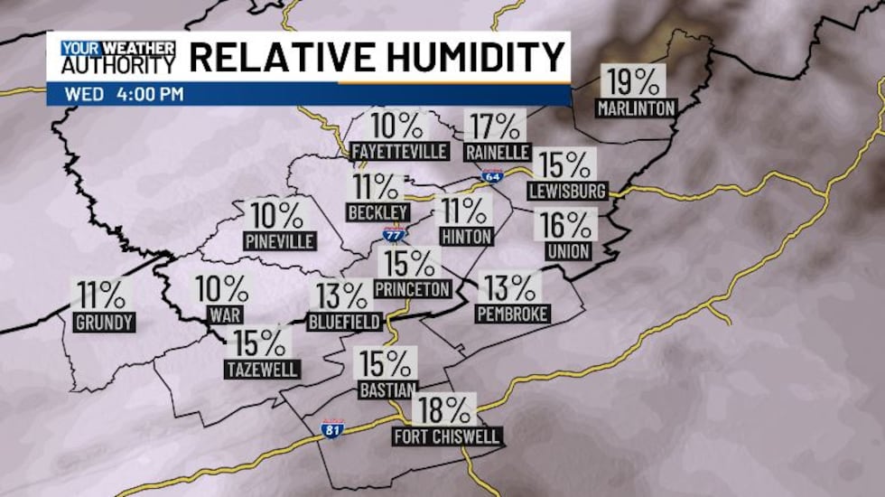
We have increased fire danger across the Two Virginias today. A Red Flag Warning goes into effect for McDowell and Wyoming counties starting at 11 AM, continuing into 10 PM this evening. A Red Flag Warning means that critical fire weather conditions are either occurring now or will shortly. A combination of strong winds, relative humidity as low as 10%, and warm temperatures into the 80s can contribute to extreme fire behavior and increased risk of wildfire ignition and spread. DO NOT BURN. A Special Weather Statement has been issued for the rest of our area until 7 PM for increased fire danger.
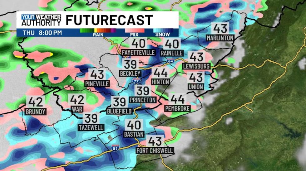
An approaching cold front tonight will bring us some scattered rain showers tomorrow morning, and temperatures falling throughout the day. These showers will move in around 6 AM, continuing off and on through lunchtime, a few rumbles of thunder could be possible with this line. After lunch, we still a bit of a break for a few hours, with rain resuming around 3:30 PM. Around 4 or 5 PM, temperatures will be cool enough to support rain switching over to snow, starting in the higher elevations. After sunset, most of us will be looking at snow, which will continue until the early morning hours on Friday. Lows drop into the mid 20s Thursday night, so we could see some slick spots on the roadways, but we’re not looking at a lot of accumulation with this snow. Most weather models put us at less than an inch for the most part, with some spots looking at slightly higher values.
We dry back up on Friday with a bit of sunshine and highs in the low 50s. Over the weekend we’re looking at a disturbance to bring us a bit of rain, with temps staying mild until the start of next week.
Copyright 2025 WVVA. All rights reserved.


