Snow showers throughout the day, becoming more scattered by evening
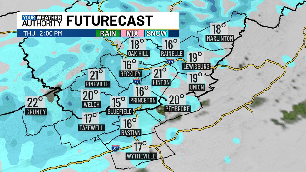
Another band of snow possible Wednesday night into Thursday morning
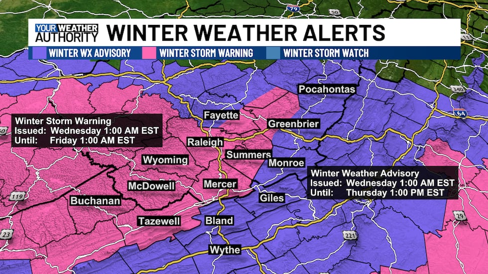
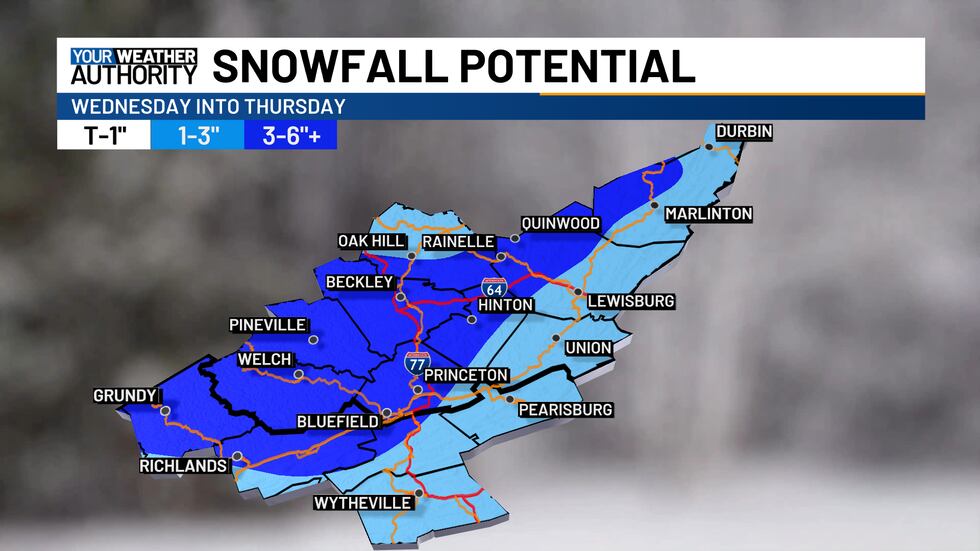
Winter storm warnings and winter weather advisories remain in effect through Thursday night.
Snow started this morning, but it began a few hours later than yesterday’s models predicted. Roadways across the area are still clear or wet, but as snow continues to move in, expect snow-covered roads throughout the morning, with temperatures in the teens and 20s. Roads may become slushier after sunrise.
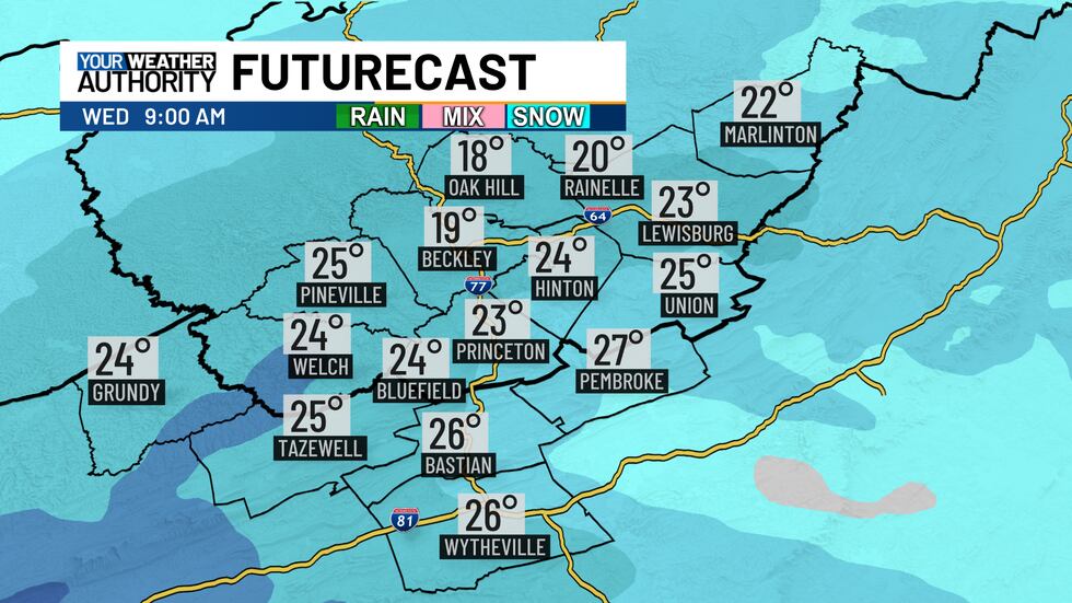
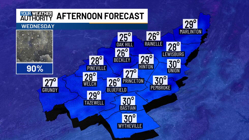
Light to moderate snow showers will persist throughout the day (some heavy snow at times), becoming more scattered by this evening. High temperatures this afternoon will stay in the 20s.
An upper-level disturbance will bring another band of snow late Wednesday night into Thursday morning.

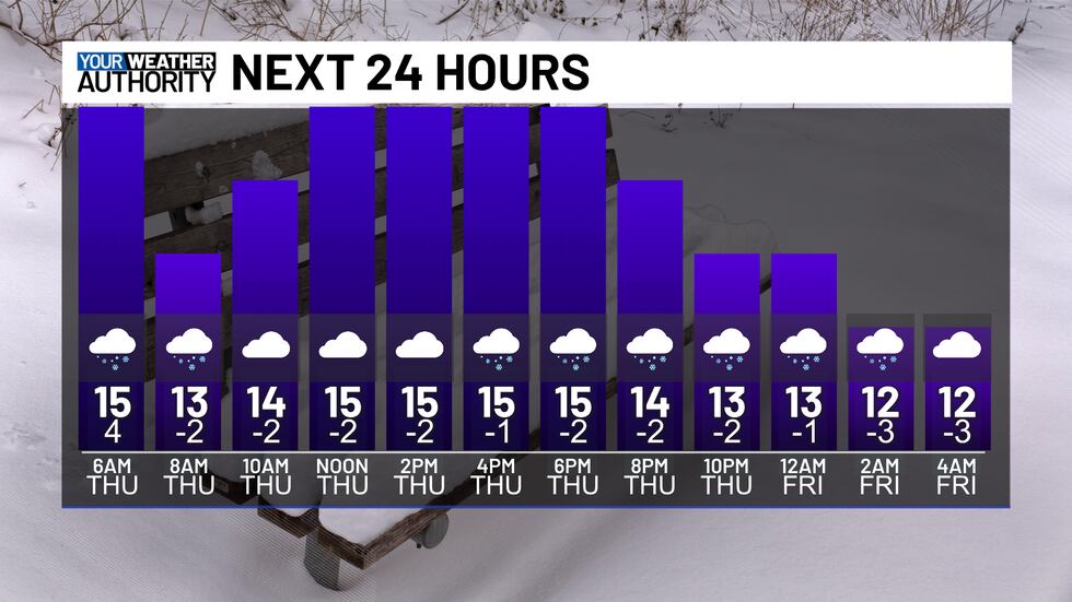
On Thursday, expect on-and-off snow showers from upslope flow due to northwesterly winds.
Snow totals are slightly lower due to the delayed arrival, with 3 to 6 inches in the winter storm warning areas and locally higher amounts possible, while winter weather advisory areas may receive 1 to 3 inches.
Winds will pick up Thursday, reaching 10 to 15 mph with gusts up to 30 mph, making wind chills feel like they’re in the single digits to below zero at times.
It will remain cold through Friday, but temperatures will begin warming up this weekend.
Copyright 2025 WVVA. All rights reserved.


