Scattered snow will continue through Thursday; dangerously cold tomorrow
Sub-zero wind chills likely into late week
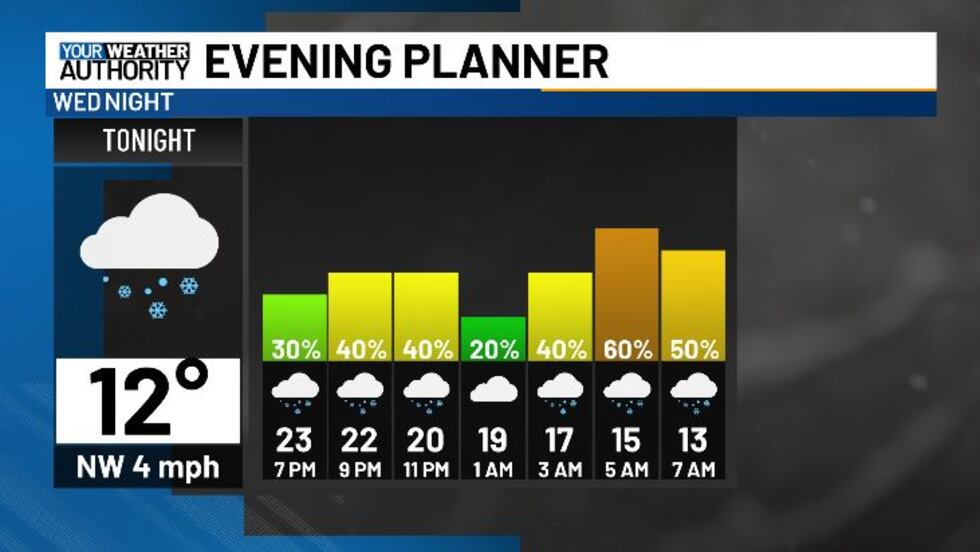
BLUEFIELD, W.Va. (WVVA) - Tonight, temps should hit the teens and single digits. Any slush will likely freeze over as black ice, and snow will continue on and off through the overnight hours, become widespread again for a while between 3AM - 6am Thursday morning. We’ll continue to see periodic snow through Thursday evening as well, ending through Friday AM.

Through tomorrow, we could see an additional 2-4″ of snow across our western slopes, with 1-2″ more likely west.
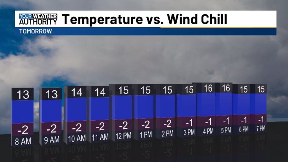
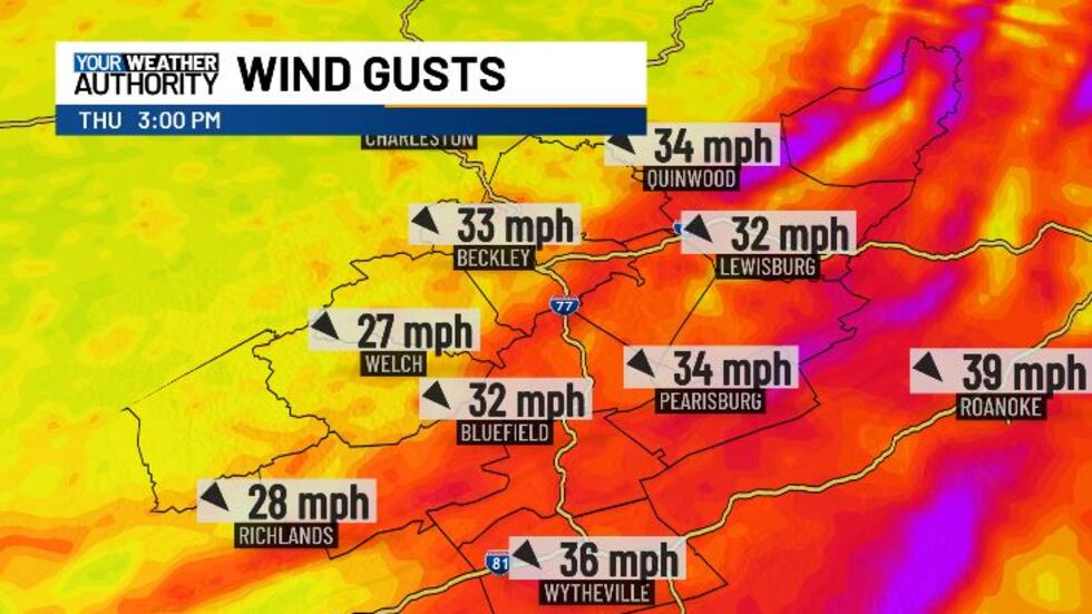
Temps will only make it into the mid-upper teens Thursday, and with the winds becoming gusty, wind chills will fall into the single digits, if not below zero for some by tomorrow afternoon.
We’ll feel the chill well into Thursday night-early Friday as temps hit the single digits for most.

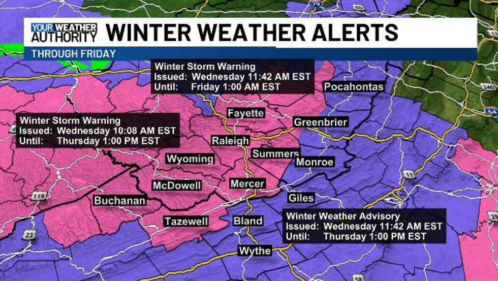
A WINTER STORM WARNING CONTINUES FOR Western Greenbrier, Fayette, Raleigh, Summers, Mercer, Wyoming, McDowell. Buchanan, and Tazewell counties.
A WINTER WEATHER ADVISORY CONTINUES FOR Pocahontas, Eastern Greenbrier, Monroe, Giles, Wythe, and Bland counties.
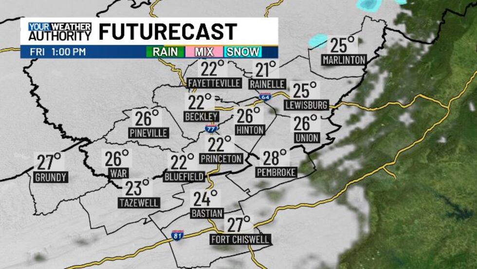
Friday, we will be drying out, will still be cold with highs in the 20s.
We finally start to warm up a bit this weekend and it should be on the quieter side for a while...
STAY TUNED!
Copyright 2025 WVVA. All rights reserved.


