Frigid cold and lingering snow showers today will keep us well below average
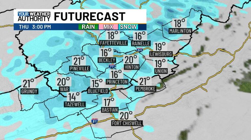
Highs today stay in the teens.
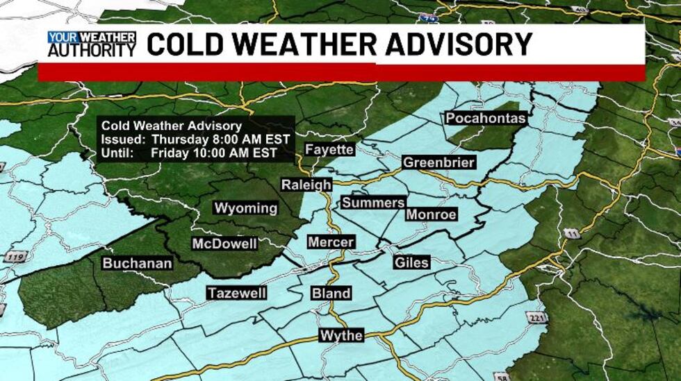
We’re looking at some very frigid air this morning, with all of our area down in the teens, and some of us feeing like the single digits thanks to wind chill. A Cold Weather Advisory goes into effect at 8 AM for Tazewell, Bland, Wythe, Giles, Mercer, Summers, Monroe, Greenbrier, eastern Raleigh & Fayette, and northwestern Pocahontas counties until 10 AM tomorrow morning. The cold wind chills as low as 10 below zero could result in hypothermia if precautions are not taken. Wind chill values and very cold temperatures can lead to hypothermia with prolonged exposure.
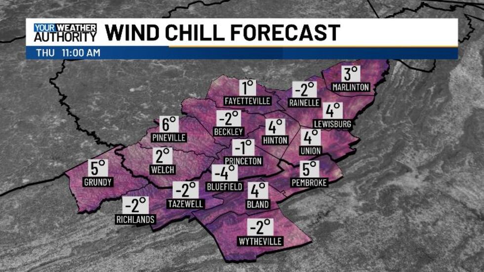
Wind chills will be coldest around lunchtime, sitting a few degrees below zero. We will continue to stay this cold into the overnight hours and tomorrow morning. Friday afternoon will bring about better conditions, but we still stay below freezing.
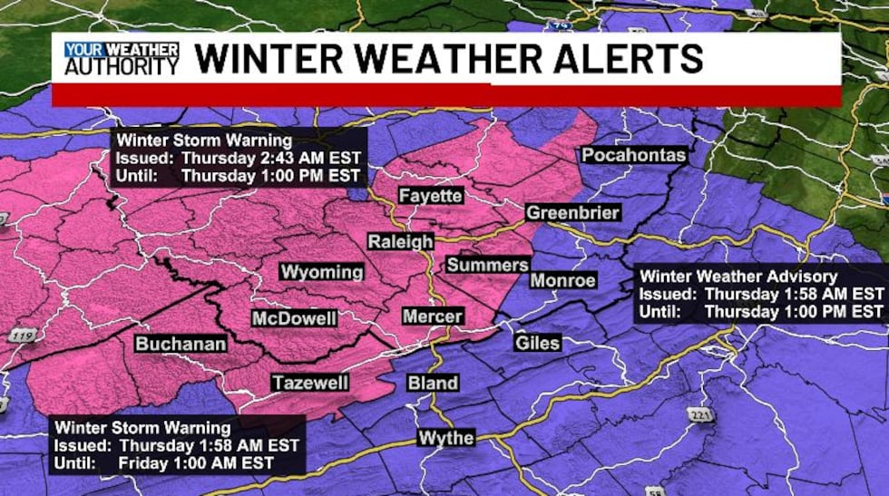
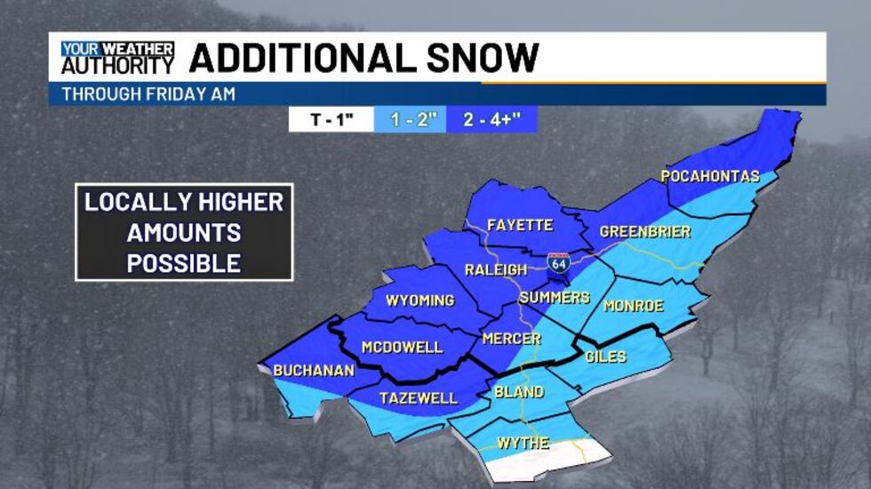
We have more snow building into the Two Virginias this morning from the west. A Winter Storm Warning continues until 1 AM tomorrow for Tazewell, Mercer, Summers, and western Greenbrier counties, and until 1 PM this afternoon for Buchanan, McDowell, Wyoming, Raleigh, and Fayette counties. A Winter Weather Advisory is in effect for all other counties until 1 PM this afternoon. Main hazards will be heavy snow, with additional accumulations between 2 and 4 inches. Winds gusting as high as 40 mph. Roads, and especially bridges and overpasses, will likely become slick and hazardous. Plan on slippery road conditions. The hazardous conditions could impact the Thursday morning and evening commutes.
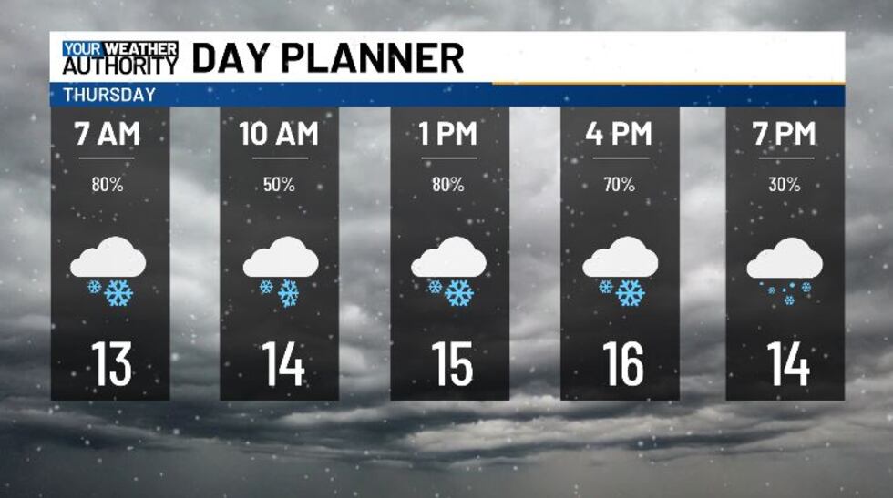
The snow moving in now will be hit or miss after lunchtime. We will see another wave moving in after 1 PM, giving us more snow showers into the evening hours. Overnight the snow will largely come to an end, with partly cloudy skies on deck for tomorrow. Temperatures tonight get down into the low teens and upper single digits, so make sure to bundle up as warmly as you can. Most of us are looking at another few inches of accumulation today, with the highest amounts on the western side of the mountains.
Tomorrow we’re going to dry up with a bit of sunshine, but temperatures will largely stay below freezing, dropping into the low teens again Friday night. Saturday we will start to recover, reaching back up into the 40s. Next week looks to start off on a mild note, as we get back into the 50s.
Copyright 2025 WVVA. All rights reserved.


