Dry weather continues with a warming trend for the start of next week
Temperatures will be warmer starting on Monday
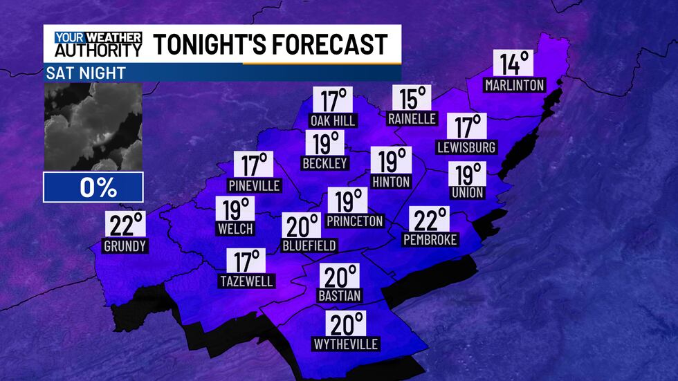
A weak disturbance may bring a stray shower to our south this evening, but otherwise, expect mostly cloudy skies that will become partly cloudy overnight. It will still be chilly, but not as cold as last night, with low temperatures in the upper teens to low 20s.
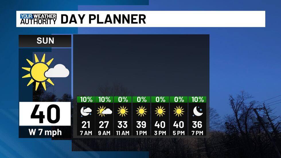
On Sunday, early to mid-morning clouds will give way to sunny skies in the afternoon. Highs will range from the upper 30s to mid-40s.
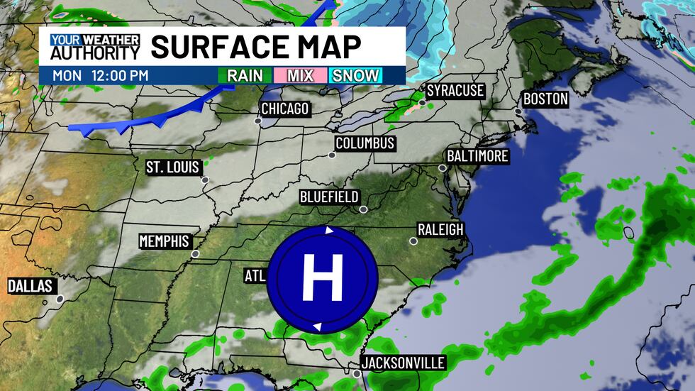
High pressure to our south will keep the area dry from Sunday night through Tuesday as disturbances bypass the area to the north.
Southwesterly winds will bring a warming trend to start the new week, with highs returning to the low to mid-50s on Monday and Tuesday, and upper 50s to low 60s by Wednesday, ahead of the next cold front.
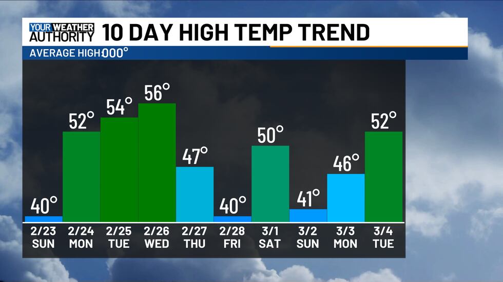
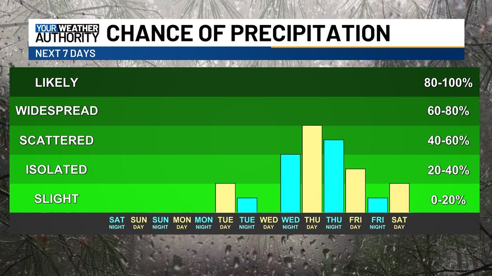
This front looks set to bring rain showers from Wednesday night into Thursday.
Copyright 2025 WVVA. All rights reserved.


