Mild start to the week, dry on Monday, with a few showers possible on Tuesday
A weak front to our north may bring a few showers on Tuesday, a better rain chance on Thursday
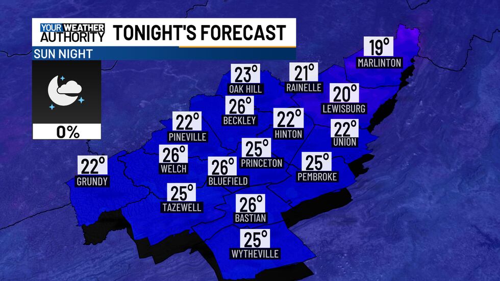
A few high, thin, wispy clouds may drift through the area this evening, but skies will remain mostly clear. Tonight won’t be as cold, with lows in the 20s, though a few colder spots could still drop into the upper teens.
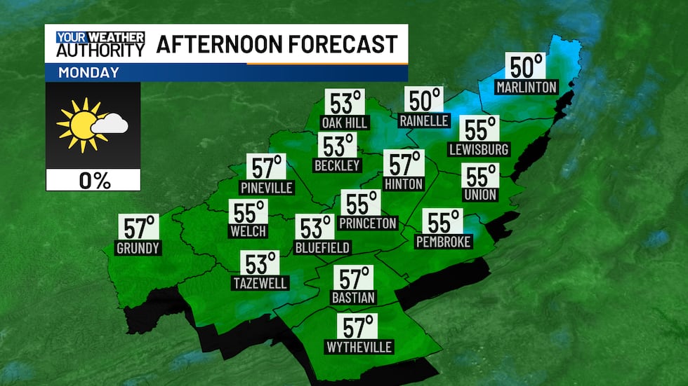
On Monday, expect sunny skies with some clouds moving in during the afternoon and evening. Temperatures will rise 10 to 15 degrees higher than today, reaching the 50s.
Those 50s will stick around for most of the week, and by Wednesday, temperatures could approach 60 degrees, with lower elevations climbing into the low 60s.
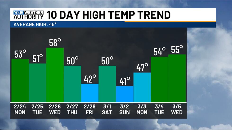
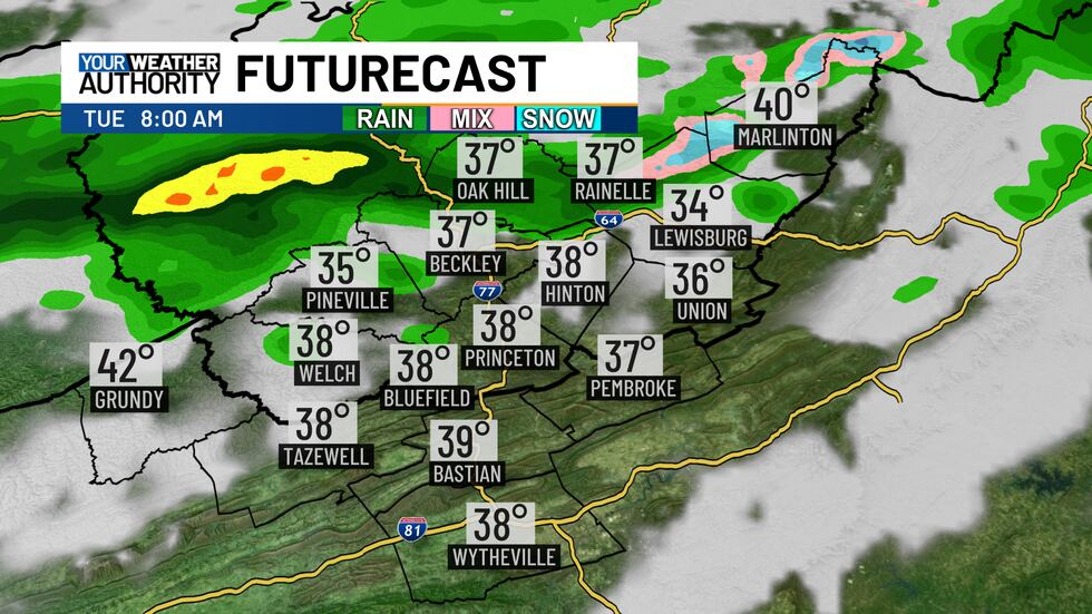
A few cold fronts will briefly cool things down toward the end of the week. The first cold front to the north will increase cloud cover on Tuesday and may bring a few showers from mid-morning to early afternoon. If moisture arrives early enough, northwestern Pocahontas County could see some snow mixing in, but most areas will experience only rain. Winds will pick up with this front, with gusts reaching up to 25 mph.
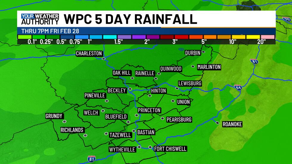
The second cold front on Thursday will bring another chance for rain, with totals ranging between a quarter and half an inch.
Colder air will move in, changing rain to snow from Thursday night into Friday, but any accumulation looks to be light for now.
Copyright 2025 WVVA. All rights reserved.


