Wednesday looks mild and dry; light rain moves in Thursday
We look to be warmer than average again tomorrow
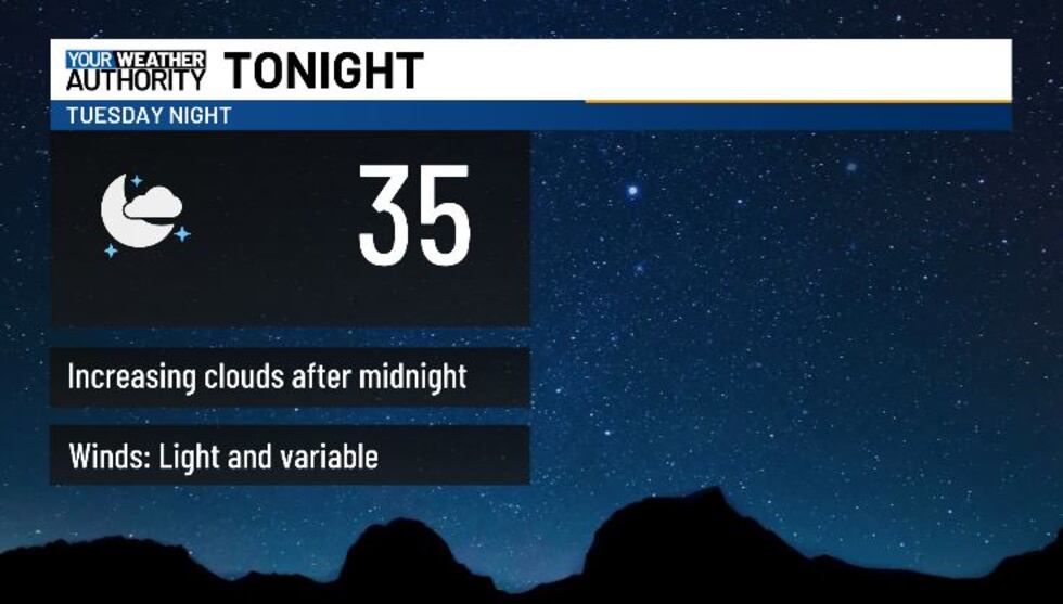
BLUEFIELD, W.Va. (WVVA) - Tonight, temps will dip into the 30s under partly cloudy skies. Aside from patchy frost, we look quiet overnight, and more sun is on the way for Wednesday.
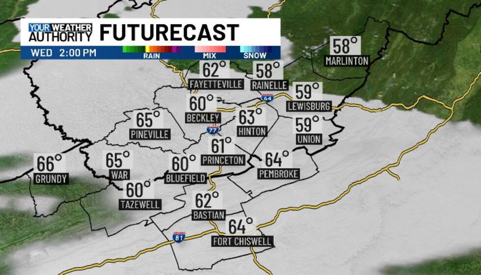
SW winds will keep us warmer than normal through midweek; high temps should hit the 50s and low 60s Wednesday afternoon. We’ll see increasing clouds into Wednesday evening ahead of an incoming cold front.
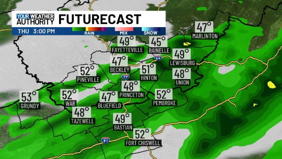
Thursday is looking wet as the front moves in, and we’ll likely see mainly light rain on and off through the day. Highs Thursday will be seasonable, in the upper 40s-low 50s. We’ll drop into the upper 20s-low 30s Thursday night-early Friday, allowing for a brief change-over to snow/flurries through Friday AM.
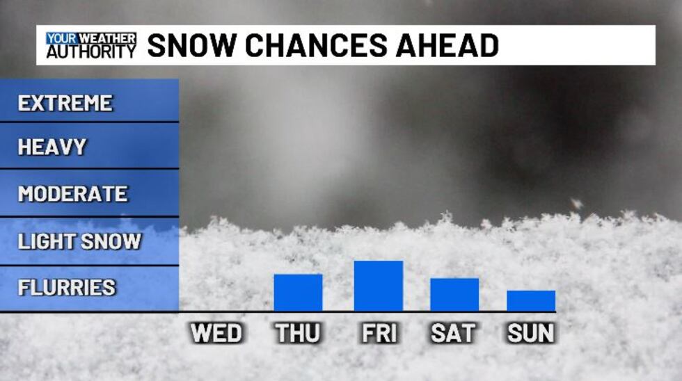
Rain nor snow will add up to much this time around. With about rain totals looking to be around 0.5″ (give or take a tad), and snow to be less than an inch as well. We’ll be breezy Thursday and Friday, and the end of the week will be cooler with highs in the 40s Friday afternoon. Our next frontal system moves in this weekend, but it won’t look to have much moisture with it, we likely will just be cloudy at times Sat-Sun. Saturday, temps will be mild, but we look colder on Sunday....
STAY TUNED!
Copyright 2025 WVVA. All rights reserved.


