High temperatures today feel like mid-April, accompanied by some April showers tomorrow
Highs will be in the 60s today.
Temperatures are starting out on a warm note this morning, with some of us in the low 40s and upper 30s. Yesterday we ended up hitting 58 degrees, 12 degrees higher than our normal for this time of year. Nowhere near our record of 72 degrees though, set back in 1930. Our low was also 10 degrees above normal.

This morning will be mostly to partly cloudy with temperatures in the upper 30s. We quickly warm up, reaching into the mid 40s around 9 AM, and low 50s by 10:30. This afternoon will be the warmest we’ve seen all week, with temperatures pushing into the 60s.

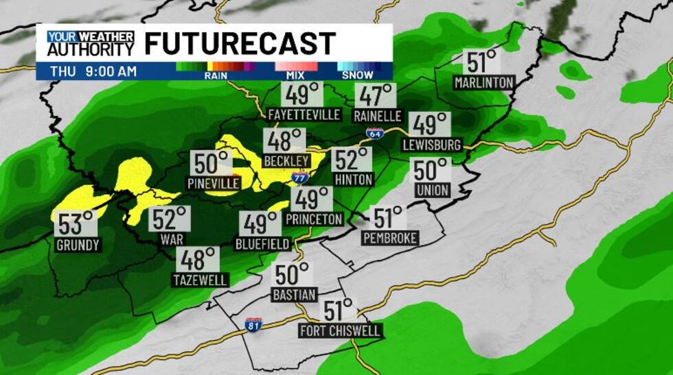
Rain chances will increase tomorrow morning as a cold front passes through. We may end up seeing some stray showers ahead of that front late tonight. Widespread rain starts around 5 AM tomorrow morning, and we’ll continue to see scattered showers up until lunchtime. After 1 or 2 PM we could see some clearing through dinner time. The rain will start up again late Thursday, and with colder air moving in, we could see some flakes mixing in. No snow accumulation is expected. Rainfall amounts are looking light, with most of us looking at less than a quarter of an inch of rain.
We could see some leftover flurries into Friday morning, but the afternoon will be dry. Saturday we could end up seeing some scattered showers, but Sunday is shaping up to be dry and cold.
Copyright 2025 WVVA. All rights reserved.


