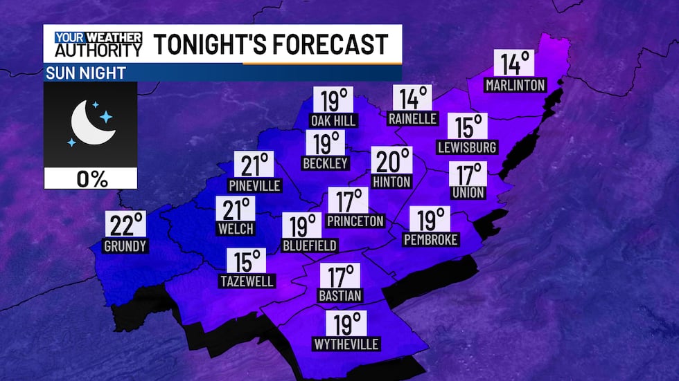
Another cold night in the teens & 20s, a warm-up for the start of the new week
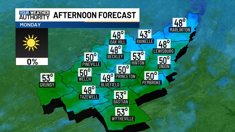
Monday afternoon highs in the upper 40s to low 50s
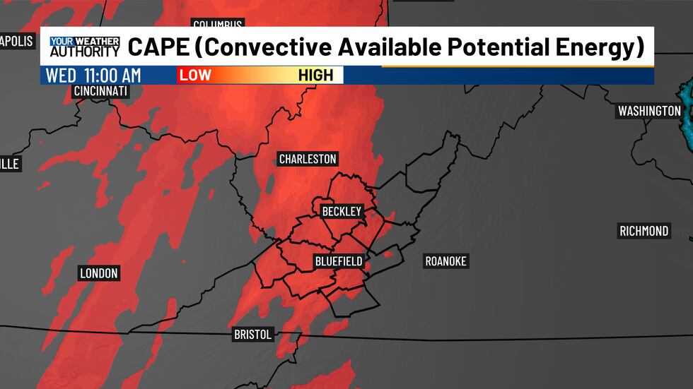
High pressure will remain in control tonight and Monday. By Tuesday, a storm system developing over the Rockies will move east, spreading cloud cover across the region. Rain will likely arrive by Tuesday night, with a chance for thunderstorms on Wednesday. Winds will pick up on Tuesday, becoming stronger on Wednesday as the cold front approaches.
In the short term, expect clear skies and another cold night, with lows dropping to the mid-teens and low 20s.
On Monday, with high pressure settled over the Mid-Atlantic, skies will stay sunny, and temperatures will be seasonable, reaching the upper 40s to low 50s.
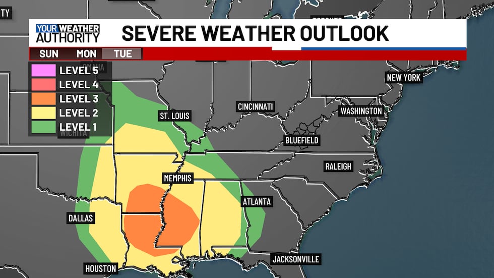
By Tuesday, a low-pressure system moving across the Great Plains will bring increasing clouds to the area. Meanwhile, states across the mid-south could see strong to severe thunderstorms.
Rain will start moving in as early as Tuesday night, with the potential for thunderstorms by late Wednesday morning into the early afternoon.
Currently, the severe weather threat for our area remains low, but strong gusty winds aloft could allow for a few storms with damaging winds. Stay tuned for updates!
Copyright 2025 WVVA. All rights reserved.


