Spring-like weather returns today, with some severe weather possible later in the week
Highs today will be back in the 50s.
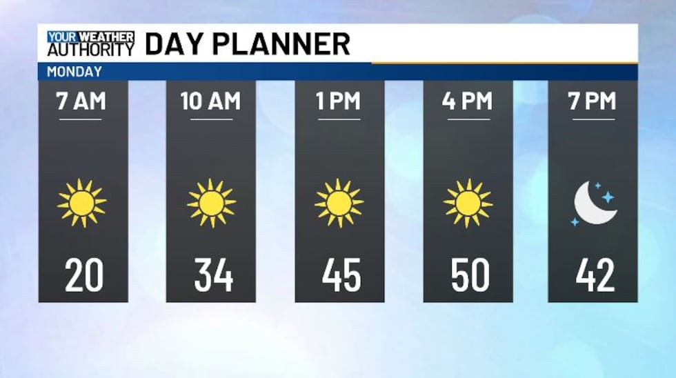
We’re going to be waking up to some very chilly weather this morning, with many of us down in the teens and low 20s. Things are looking clear on our satellite and radar, the reason why we’re so cold this morning. High temperatures today will be topping off in the low 50s, as we hold onto abundant sunshine this afternoon. Overnight we’re going to get down near freezing, with a few clouds moving in.
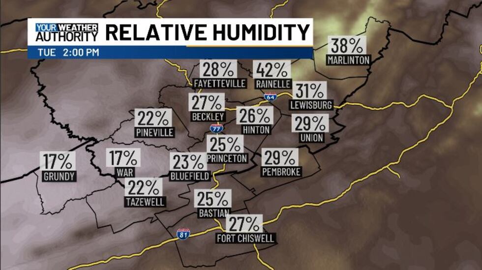
Tomorrow we’re looking at an elevated risk for fire danger, due to gusty winds and low relative humidity on top of dry fuels. Wind gusts will pick up considerably into tomorrow afternoon, with sustained winds of around 15 mph and gusts up to 25 mph or higher. We’ll see those winds pick up even more overnight. Relative humidity will fall off sharply during the same time frame, reaching down near 15% / 20%. Now that we’re in March, bun bans are in effect from 7 AM until 5 PM in West Virginia. The 4 PM Burn Law is also in effect on the Virginia side. Burning will not be advised in our area, and those working outside should be very careful around sparks.
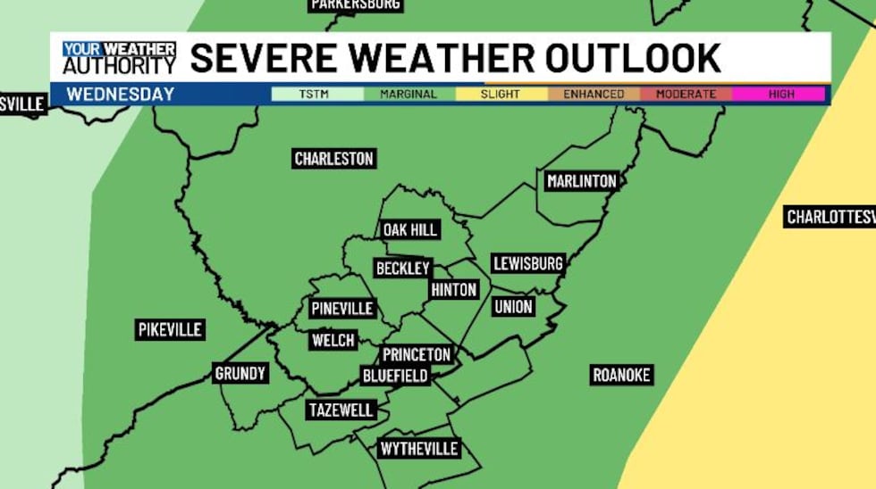
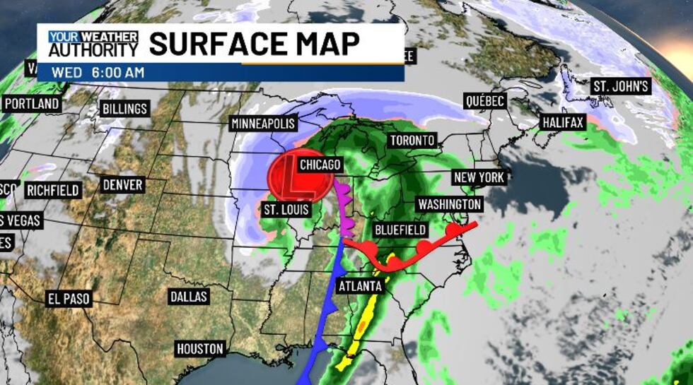
On top of that, a very strong frontal system will be passing through late tomorrow night into Wednesday. It will bring with it the chance from some stronger thunderstorms. Our entire area has a marginal risk for severe weather Wednesday, with the main threat being damaging winds, with some weak rotation also possible. Make sure to stay weather aware tomorrow night into Wednesday morning and have a way to get weather alerts.
This frontal system will begin trekking across the country tomorrow, bringing storms to the great plains and southern tier. After it crosses our area, we’re going to see some cold northwesterly flow, and as a result we could see some snow on Thursday. Snowfall amounts are looking to be on the light side for now, but we’ll keep a close eye on totals as we get closer, as some of us could see up to three inches.
Outside of the cold snap on Thursday, this week is looking spring-like again. Long range guidance is suggesting that next week is going to start off really hot, with temps in the 60s.
Copyright 2025 WVVA. All rights reserved.


