Dry and windy weather leads to elevated fire danger this afternoon. Severe weather chances increase tomorrow
This afternoon will be spring-like once again.
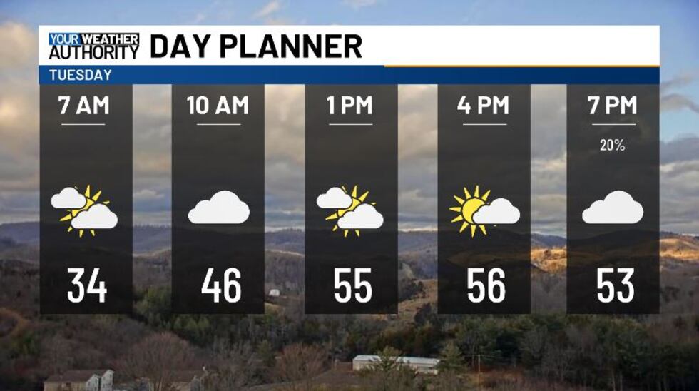
We’re going to be waking up a bit on the chilly side this morning, with 30s and low 40s. We have some heavier clouds rolling in this morning, and we’ll stay pretty cloudy throughout the next few hours. Skies will be mostly cloudy to partly cloudy this afternoon, with highs topping off in the mid and upper 50s.
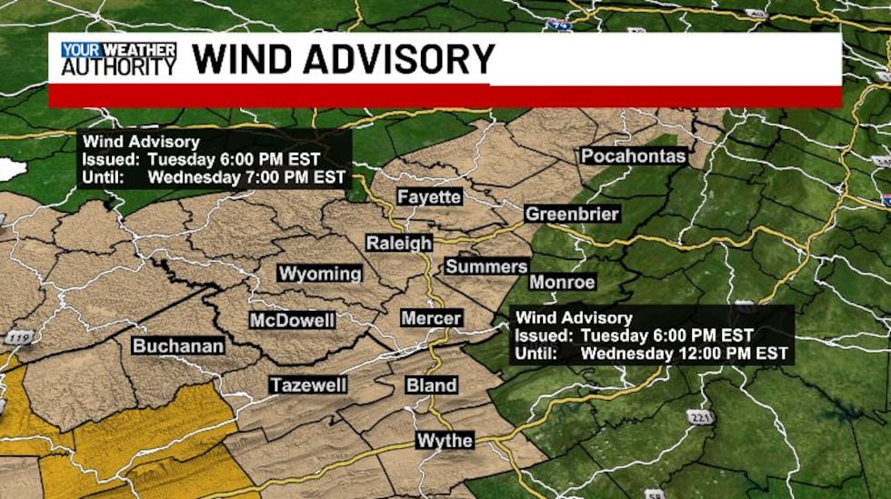
A Wind Advisory has been issued for Fayette, Raleigh, Wyoming, McDowell, Buchanan, Tazewell, Mercer, Summers, Bland and Wythe counties starting at 6 PM this evening until tomorrow at noon for Mercer, Summers, Tazewell, Bland, and Wythe counties, and until 7 PM tomorrow for everyone else. Sustained winds of 20 to 30 mph from the south are expected, with gusts of 50 mph or more possible. Gusty winds will blow around unsecured objects. Tree limbs could be blown down and a few power outages may result.
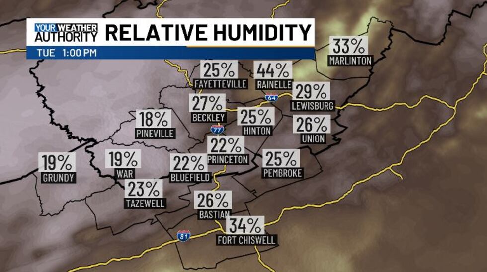
Today we’re looking at an elevated risk for fire danger, due to the gusty winds and low relative humidity on top of dry fuels. Relative humidity will fall off sharply after lunchtime, reaching down near 15% / 20%. Now that we’re in March, bun laws are in effect from 7 AM until 5 PM in West Virginia. The 4 PM Burn Law is also in effect on the Virginia side. Grass, brush, leaf and tree litter are very dry. Any ignition source may quickly get out of control this afternoon due to increasing wind speeds. For your safety and the safety of others, you are urged to avoid outdoor burning today. If you work with equipment that generates sparks, such as chainsaws or grinding tools, please ensure that fire suppression equipment is readily available. Properly extinguish and dispose of any smoking materials.
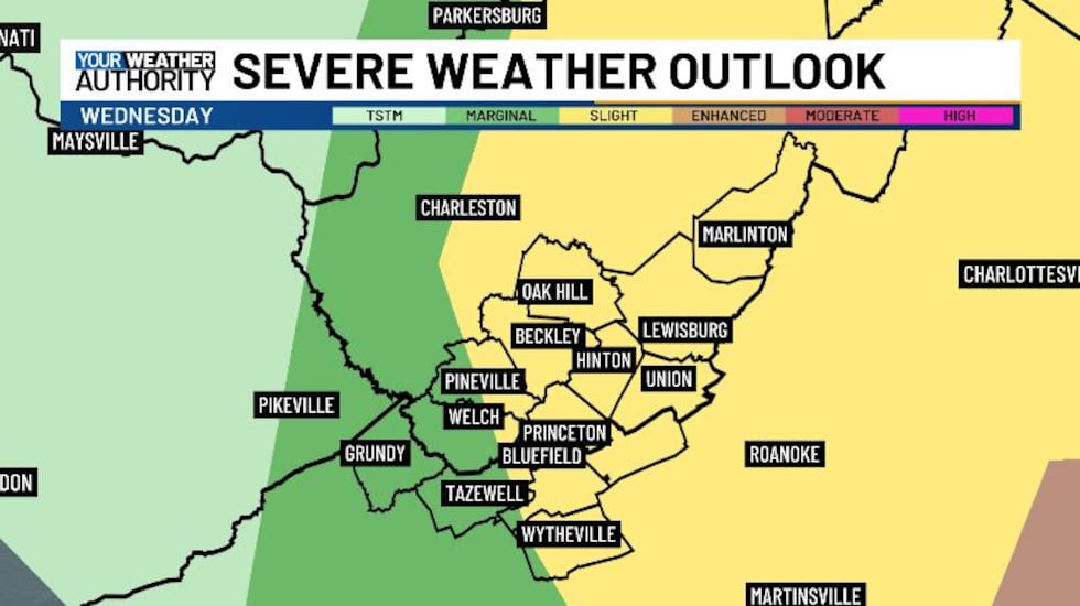
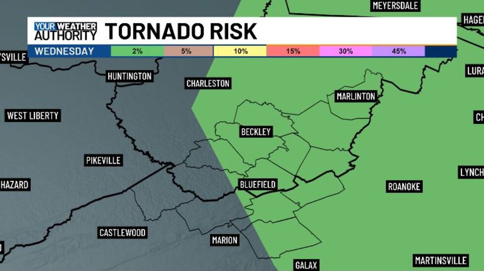
On top of that, a very strong frontal system will be passing through late tonight into Wednesday. It will bring with it the chance from some stronger thunderstorms. Most of our area has been upgraded to a slight risk, with the main threat being damaging winds and large hail, though we also could see some weak rotation, as we have a 2% tornado risk. Make sure to stay weather aware tonight into Wednesday morning and have a way to get weather alerts.
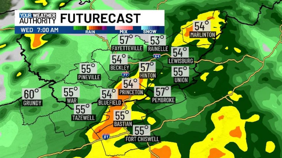
We might see some pop-up showers before midnight tonight, but most of the rain moves in around 2-3 AM. Storms will start popping up around 6 or 7 AM, and this when we’re concerned about severe weather. The storms look to be pretty fast moving, exiting our area after 9 AM. We stay a bit quiet through the mid afternoon. Around 3 PM we could see another round of thunderstorms, and these could end up being stronger than the morning storms thanks to increased instability from any sunshine we see after the morning storms. After sunset the temperatures will begin falling, and rain will switch over to snow. We will continue to see snow through Thursday afternoon.
Snowfall amounts are looking to be on the light side for now, but we’ll keep a close eye on totals as we get closer, as some of us could see up to three inches. Outside of the cold snap on Thursday, this week is looking spring-like again. Long range guidance is suggesting that next week is going to start off really hot, with temps in the 60s.
Copyright 2025 WVVA. All rights reserved.


