Rain will roll in by Wednesday morning, some severe storms will be possible
A strong frontal system moves in midweek

BLUEFIELD, W.Va. (WVVA) - Tonight, temps will hover in the 40s and 50s, and winds will begin to get gusty.
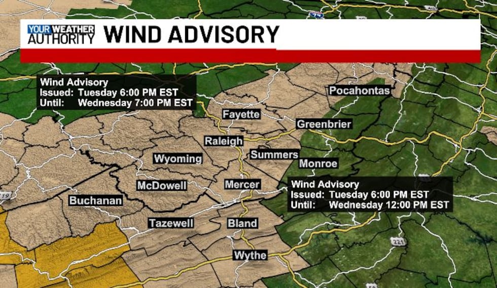
A WIND ADVISORY IS IN EFFECT FOR NW POCAHONTAS, WESTERN GREENBRIER, FAYETTE, RALEIGH, SUMMERS, WYOMING, MCDOWELL, MERCER, BUCHANAN, TAZEWELL, BLAND AND WYTHE COUNTIES TUESDAY NIGHT- WEDNESDAY AFTERNOON.
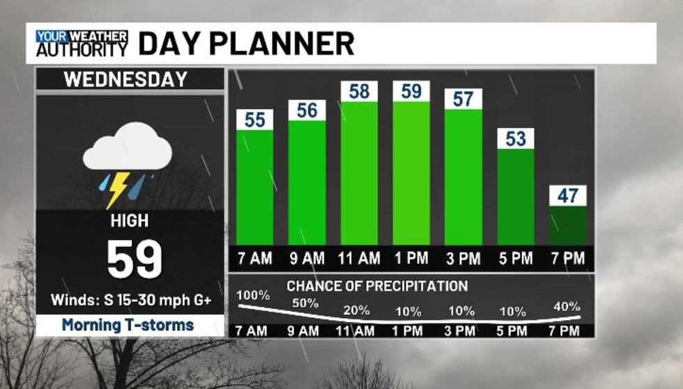
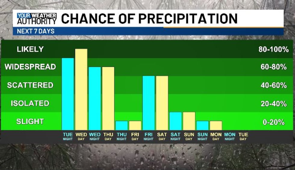
A few showers could pop up overnight, but most of the rain will hold off until early Wednesday AM. On and off until around 12 PM, we look to see rounds of showers and thunderstorms, some of which could be strong to severe, with damaging winds the main threat.
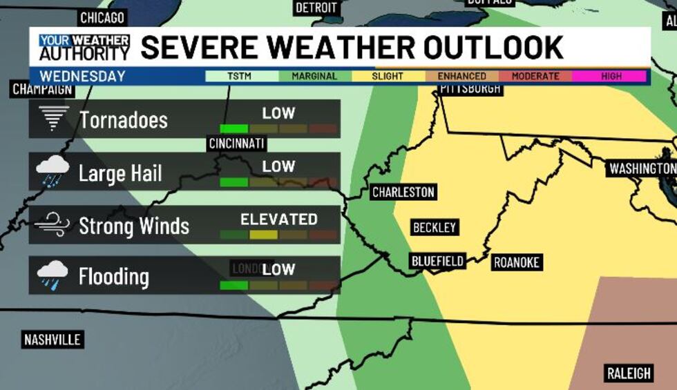
A few weak tornadoes, along isolated hail can’t be completely ruled out either, though the risk is low- same with flooding this time around. We look drier into Wednesday night for a while, but we’ll turn colder, with lows hitting the 20s and low 30s Wednesday night.
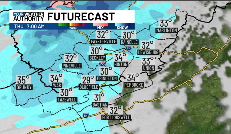
Snow will develop into Thursday, and some minor accumulations look possible across our western facing slopes (generally 1-3″).
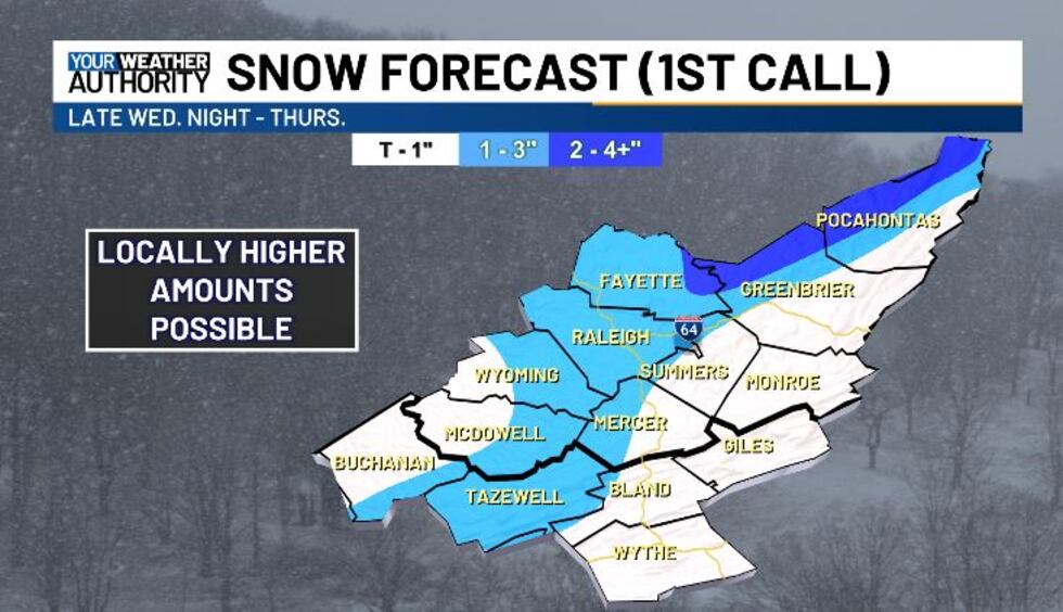
We look cold and breezy Thursday with highs in the 30s.
This weekend we look more seasonable temp-wise, but still a tad unsettled with some occasional rain/snow.
STAY TUNED!
Copyright 2025 WVVA. All rights reserved.


