Severe storms possible today, with rain switching to snow overnight
Stay weather aware this afternoon.
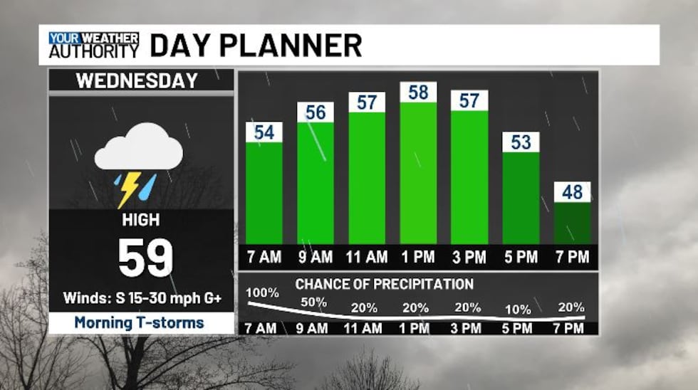
We’re looking very mild this morning, with temperatures starting out in the 50s, topping off in the upper 50s and low 60s this afternoon.
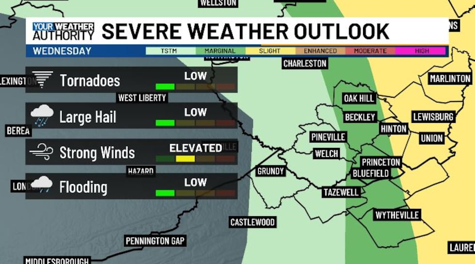
We have the chance to see some severe weather today, with a slight risk for our eastern counties, and a marginal risk right down the I-77 corridor. The main threat being damaging winds and large hail, though we also could see some weak rotation, as we have a 2% tornado risk. Make sure to stay weather aware today.
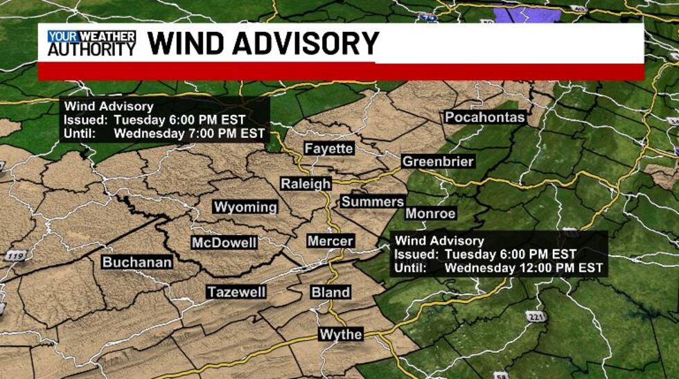
A Wind Advisory has been issued for Fayette, Raleigh, Wyoming, McDowell, Buchanan, Tazewell, Mercer, Summers, Bland, western Greenbrier and northwestern Pocahontas and Wythe counties until noon for Mercer, Summers, Tazewell, Bland, western Greenbrier and Wythe counties, and until 7 PM for everyone else. Sustained winds of 20 to 30 mph from the south are expected, with gusts of 50 mph or more possible. Gusty winds will blow around unsecured objects. Tree limbs could be blown down and a few power outages may result.
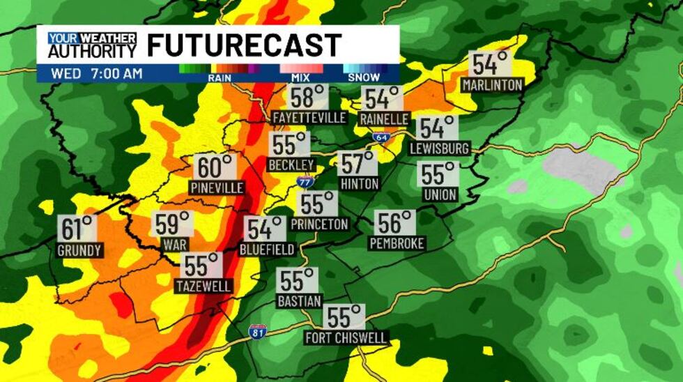
This morning we’ll see the first round of thunderstorms. Gusty winds are likely with this line, but the main severe threat will come later this afternoon. Around lunchtime we’re going to see a break from the rain, as the main like moves off to the east. Sunshine will be possible between 11 AM and 2 PM, and that could provide more instability for thunderstorms. A second round of thunderstorms will be possible between 3 PM and sunset. These storms have the potential to be stronger than the ones that roll through this morning, so stay weather aware.
After sunset, temperatures will drop and rain will switch over to snow. We’ll continue to see snow for Thursday morning, making things a bit slick for the morning commute. Snow will gradually taper off after lunchtime tomorrow, giving us clear and cold conditions Thursday night. Lows tonight get down into the upper 20s, with highs only a few degrees above freezing tomorrow.
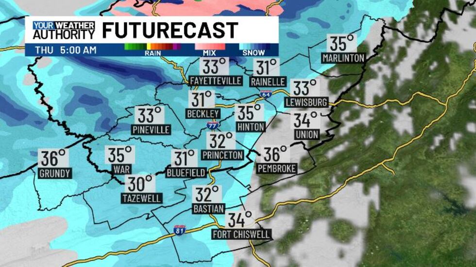
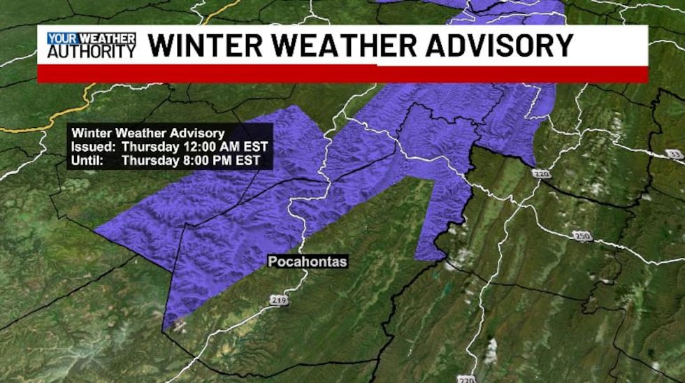
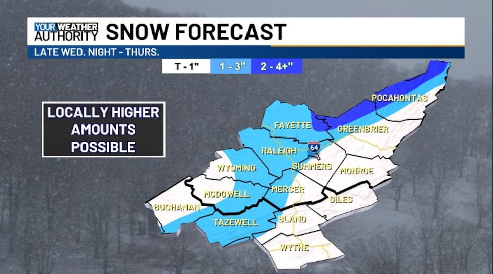
Snowfall amounts will be highest along our ridgeline, with up to three inches possible for most. A Winter Weather Advisory is in effect for northwestern Pocahontas County. Total snow accumulations up to 5 inches with winds gusting as high as 50 mph. Blowing snow is possible. Plan on slippery road conditions. The hazardous conditions could impact the Thursday morning and evening commutes. Strong winds could cause tree damage and areas of blowing snow which could reduce visibility.
As we head into Friday we see a break from the precipitation, with highs warming back up into the low 50s. Over the weekend we could see a few rain / snow showers, but impacts are looking low. Next week we’re looking to crank up the heat near 70 degrees.
Copyright 2025 WVVA. All rights reserved.


