Snow will develop into early Thursday, some slick areas will be possible
Temps drop below freezing tonight
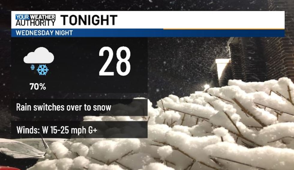
BLUEFIELD, W.Va. (WVVA) -We’ll remain windy into this evening, with some occasional spotty rain, eventually changing over to light snow overnight, which will become wider-spread into Thursday AM. Low temps tonight will hit the 20s and low 30s.
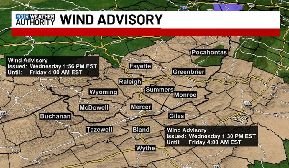
A WIND ADVISORY will continue for NW Pocahontas, Western Greenbrier, Summers, Monroe, Giles, Wythe, Bland, Mercer, McDowell, Raleigh, Wyoming and Buchanan counties until 4 AM FRIDAY.
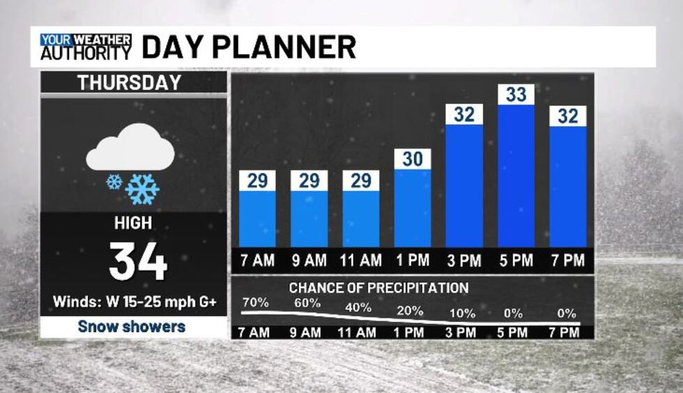
Snow will be on and off through Thursday morning, eventually tapering more into the afternoon hours.
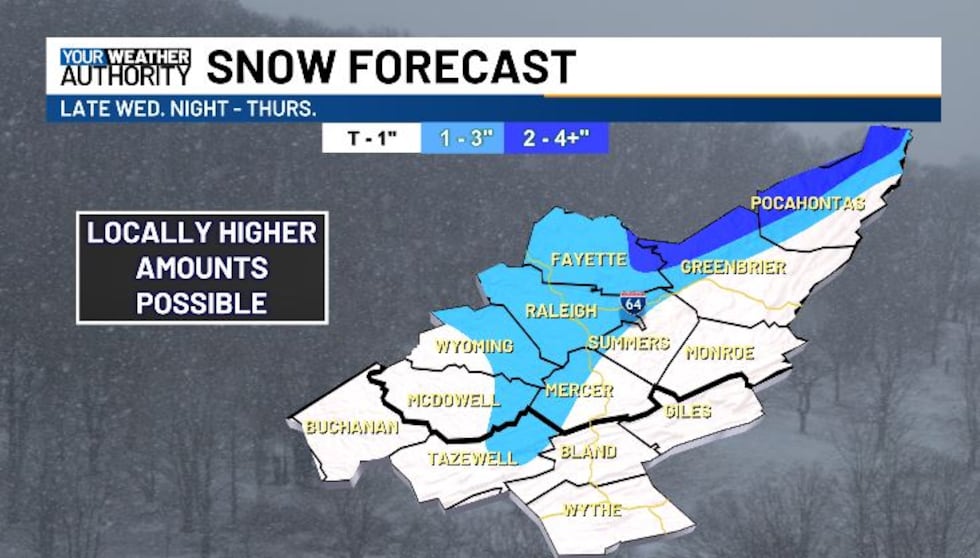
For most, snow won’t amount to much (generally a trace to an inch or 2 across most of our western facing slopes).
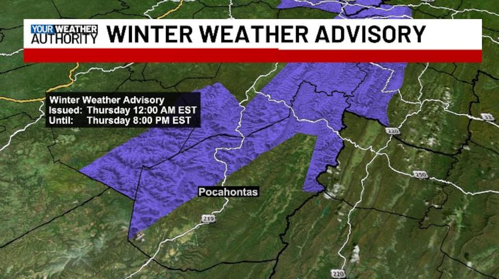
A WINTER WEATHER ADVISORY will be in effect overnight-Thursday for NW Pocahontas county- these higher peaks could see 2-4″+.

Highs tomorrow will be cold, hitting the 30s for most, but with the wind still remaining gusty, wind chills will likely be in teens and 20s through the day. Thursday night we look dry, just still cold and breezy with lows in the 20s.
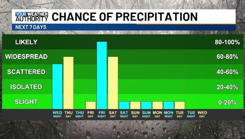
Friday looks mild, with highs in the upper 40s-mid 50s, but a frontal system will bring a bit more light rain and snow Friday night-early Saturday....
STAY TUNED!
Copyright 2025 WVVA. All rights reserved.


