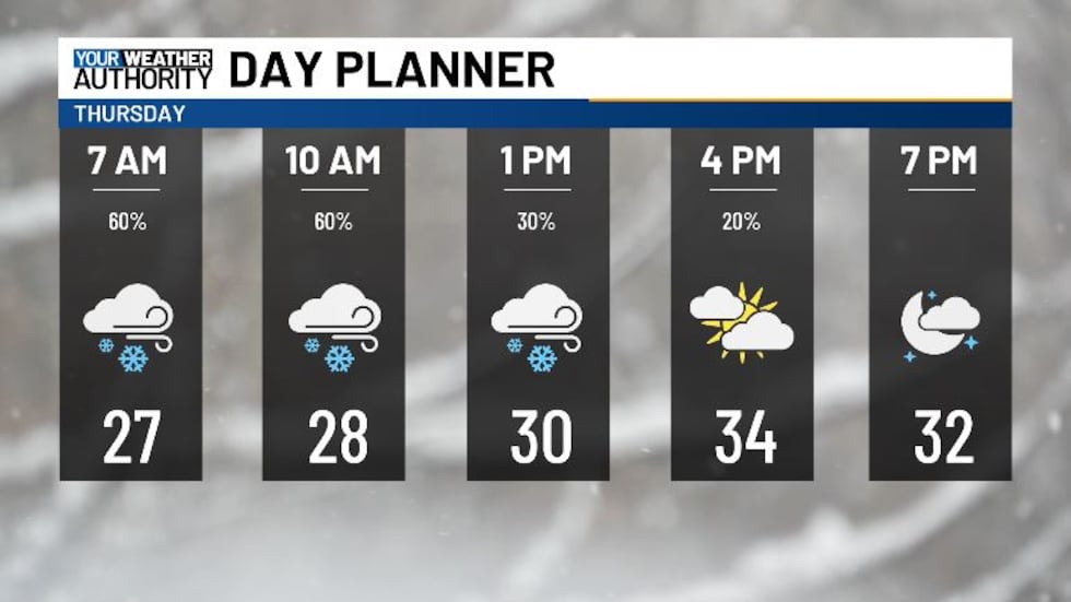
Snowflakes fall this morning, but we’re looking to clear up into the afternoon
High temps stay near freezing this afternoon.
We’re waking up a lot cooler this morning, with temperatures in the 20s and low 30s. We’ve seen a bit of snow overnight, and some more snow showers are making their way into our area this morning.
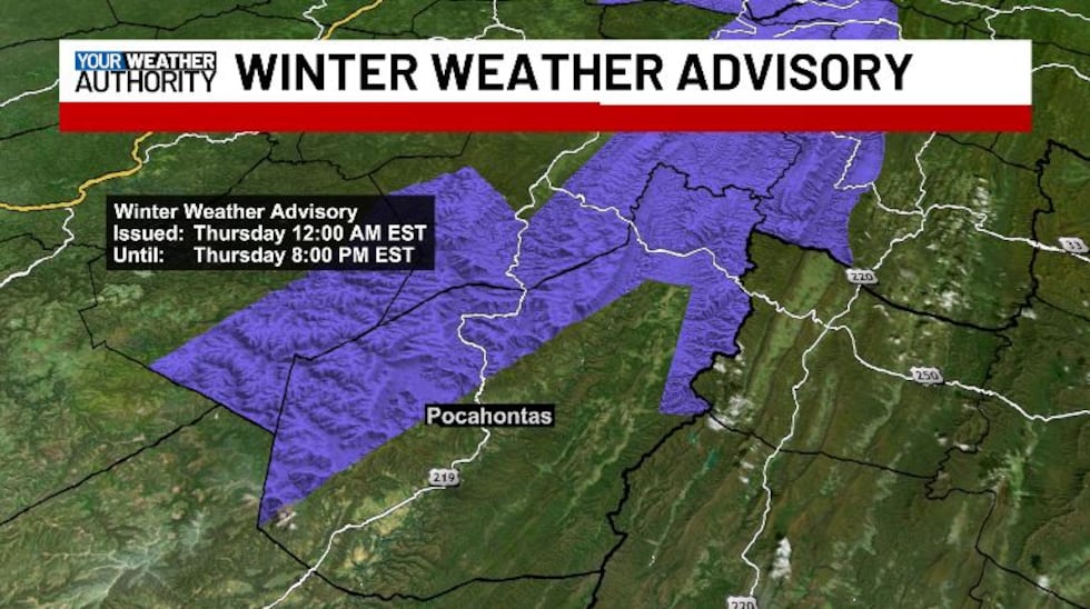
A Winter Weather Advisory is in effect for northwestern Pocahontas County until 8 PM tonight. Total snow accumulations up to 5 inches with winds gusting as high as 50 mph. Blowing snow is possible. Plan on slippery road conditions. Strong winds could cause tree damage and areas of blowing snow which could reduce visibility.
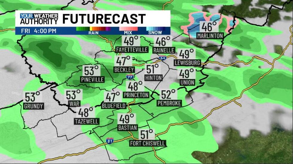
Snow showers will continue off and on until about 11 AM, and after that we’ll see some clouds taper off, giving way to a bit of sunshine. High temperatures today top off a degree or two above freezing, so we’re still staying pretty cold. Tonight, lows will drop into the mid 20s as we see mostly clear skies. We need to watch out for black ice heading into tomorrow morning. Friday is looking dry to start, with temperatures reaching up into the low 50s. We may see some light showers after 2 PM, getting more widespread overnight.
The Wind Advisory has been extended into tomorrow morning at 4 AM for all counties in our area. Northwest winds of 15 to 25 mph with gusts of up to 50 mph are possible. Gusty winds will blow around unsecured objects. Tree limbs could be blown down and a few power outages may result. Winds this strong can make driving difficult, especially for high profile vehicles. Use extra caution.
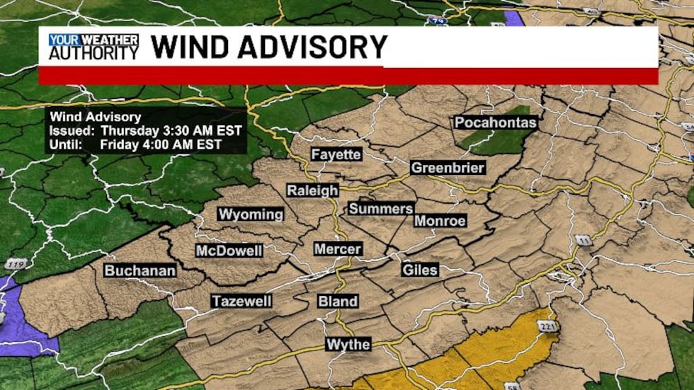
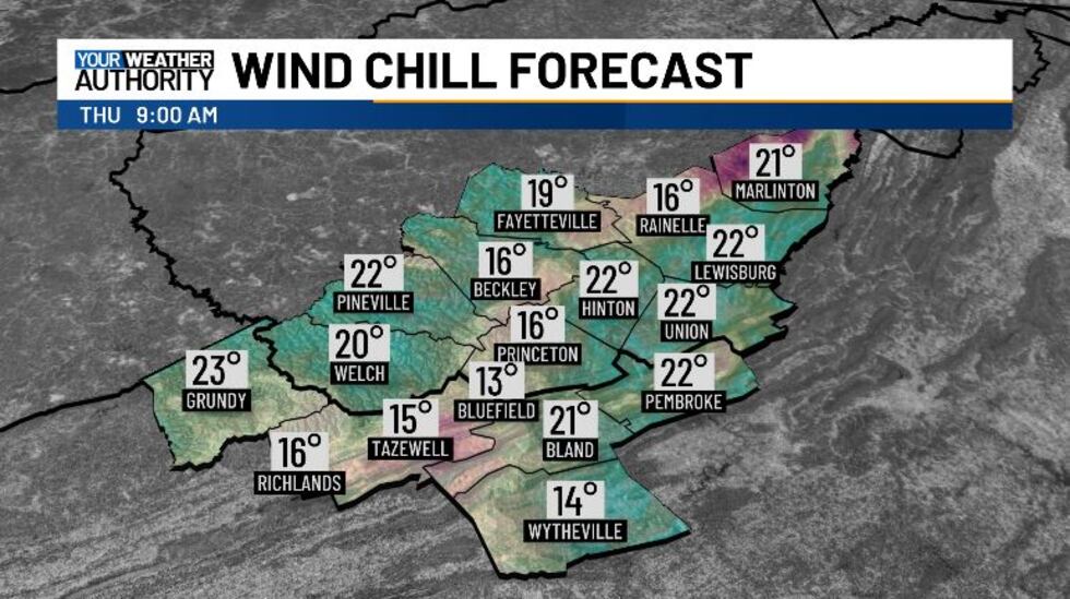
The wind gusts will be strongest around lunchtime, dying down after sunset. Due to the winds and cold temps, the wind chill values will be in the teens, with the lowest wind chill along the mountains. Make sure to bundle up as you step out the door.
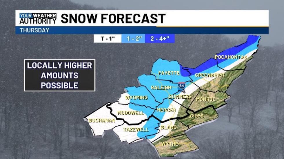
Snowfall totals have trended lower over the past 24 hours, with most of us now looking at around an inch. Most of this will be on the grass, though we could still see some slick spots. Our western slopes look to get the highest amounts, with up to 3 or 4 inches possible.
Over the weekend we’ll be a bit cool, with some morning rain possible Saturday. Next week we crank up the heat a lot, with highs near 70 degrees.
Copyright 2025 WVVA. All rights reserved.


