Today will feel more like mid-May rather than March, as we see temperatures well above average
Get ready to feel the heat.
This morning is looking very mild, as most of our area starts out in the 40s and low 50s. Yesterday was very warm, as temperatures reached up into the mid 60s. This morning has started off a lot warmer than yesterday.
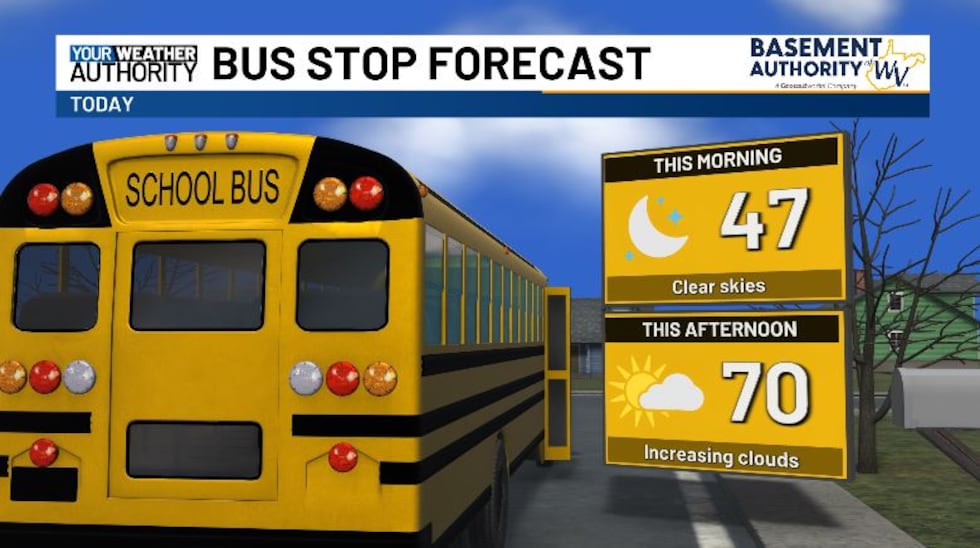
The next 24 hours are looking great for outdoor activities. We’re going to be in the upper 50s by 10 AM, and this afternoon we top off in the low 70s. Sunshine will be abundant this morning, but a few clouds roll in for the afternoon.
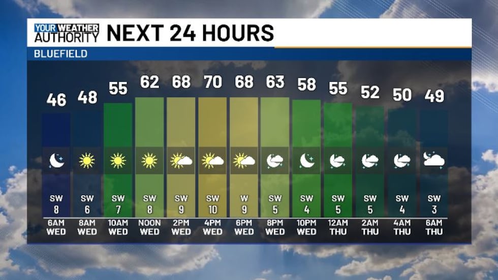
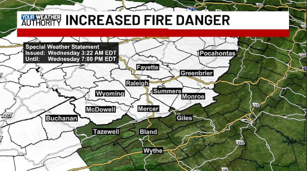
We’re also looking at low relative humidity today, falling into the 20% range, along with winds from the southwest gusting at up to 20 mph. As a result, we have increased fire danger starting late this morning through early evening. Do not burn today.
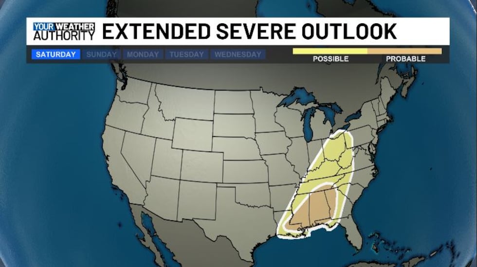
Tomorrow will be a little cloudier, but highs still look to stay near 70 degrees. We cool down a little bit into the weekend and start of next week, but warm weather will return on Tuesday. While we stay dry through the end of the week, this weekend we’re looking at the chance for some severe weather. This looks to be late Saturday evening into early Sunday morning. Make sure to stay weather aware and prepare for possible power outages due to gusty winds downing trees and power lines.
Copyright 2025 WVVA. All rights reserved.


