More clouds to start this morning, but temps this afternoon sit just as warm as yesterday
Highs will be well above normal again today.
This morning is looking very mild, as most of our area starts out in the 40s and low 50s. Yesterday’s temps climbed into the upper 60s and low 70s. Here in Bluefield, we only made it up to 68 degrees. We have another shot at hitting 70 today though.
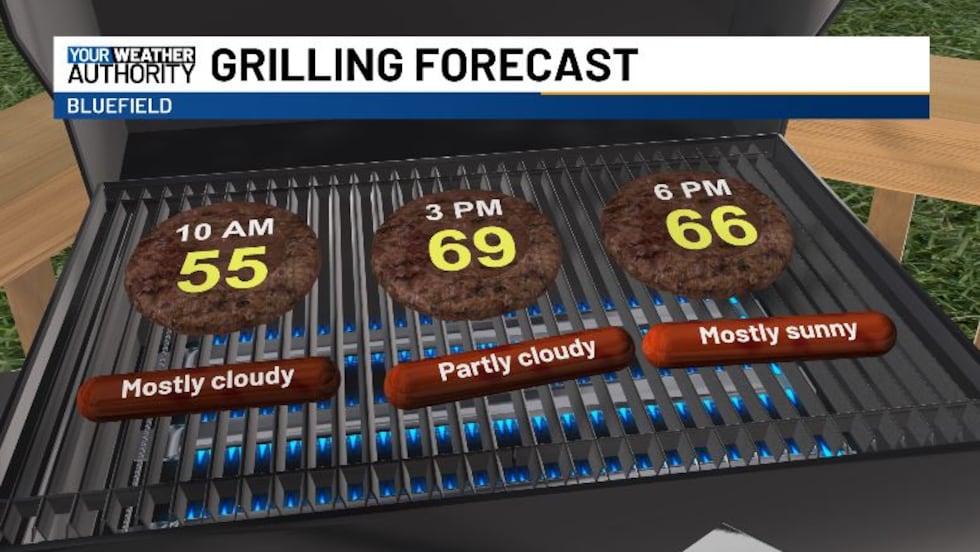
This morning is going to be mostly cloudy, with temps climbing into the upper 50s pretty quickly. This afternoon we’re looking at a bit more sunshine, with highs reaching into the upper 60s and low 70s again. Perfect weather for some outdoor grilling.
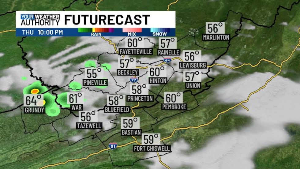
We do have the chance for a few pop-up showers and maybe a rumble of thunder. These look to be possible starting right around sunset, quieting up by midnight.
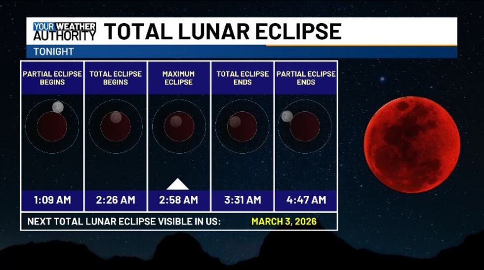
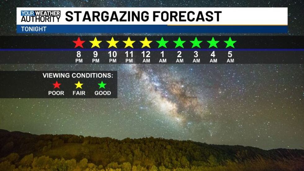
Tonight is the Total Lunar Eclipse, when the earth will be positioned between the sun and the moon, casting a shadow and making the moon appear red. The partial eclipse will begin at 1:09 AM, and the total eclipse will start at 2:26 AM, lasting a little over an hour. The partial eclipse will come to an end at 4:47. Conditions are looking good for viewing the eclipse! We do have some heavier clouds before midnight, but those will largely clear out by the time the eclipse starts. We’ll stay mostly clear the rest of the night.
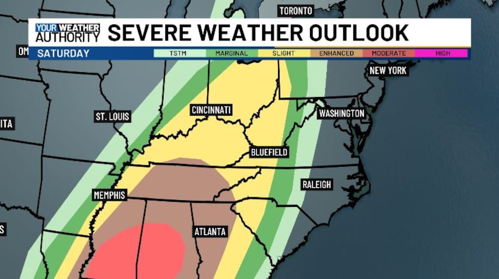
Looking ahead to the weekend, we’re starting to get a better picture of the severe weather in our area Saturday. The greatest chance for damaging storms will be well to our south, but most of our area is under a slight risk for now. We’re looking at an initial batch of storms during the morning on Saturday, and more storms could end up limiting storm potential for the evening. If that’s the case, we could see a lowered risk. If we don’t however, and instability stays high, we could see an upgrade to our severe risk. Main threats will be damaging winds, but we’re also not ruling out the possibility for some tornadic activity. Stay weather aware!
Tomorrow we’re still looking dry with some good sunshine and temps in the upper 60s. Some leftover showers will be possible into Sunday afternoon after the overnight storms. Next week is trending drier in the first half, with a cool down on Monday.
Copyright 2025 WVVA. All rights reserved.


