We’ll be mild & mainly dry to end the week, rain & wind move in this weekend
Temps will remain above average until St. Patrick’s Day
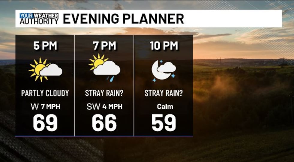
BLUEFIELD, W.Va. (WVVA) - Tonight, temps should hit the 40s, and we’ll be partly cloudy. We could see a few isolated showers/rumbles of thunder after sundown this evening as a disturbance moves in, but not everyone will see rain.
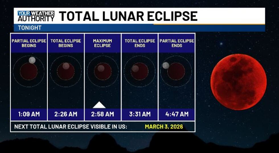
With enough breaks in the clouds after midnight, remember, we have the chance to see our full “worm moon” coincide with a total lunar eclipse around 3 AM Friday morning.
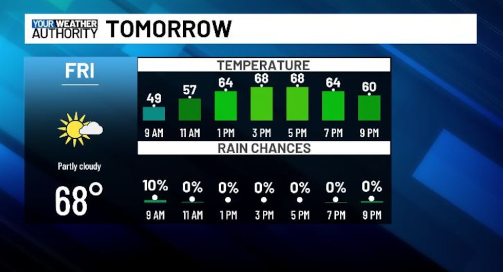
Friday will bring a mix of sun and clouds, and mild high temps in the 60s and 70s again. We look mainly dry Friday night with increasing clouds and warm overnight lows in the 50s.
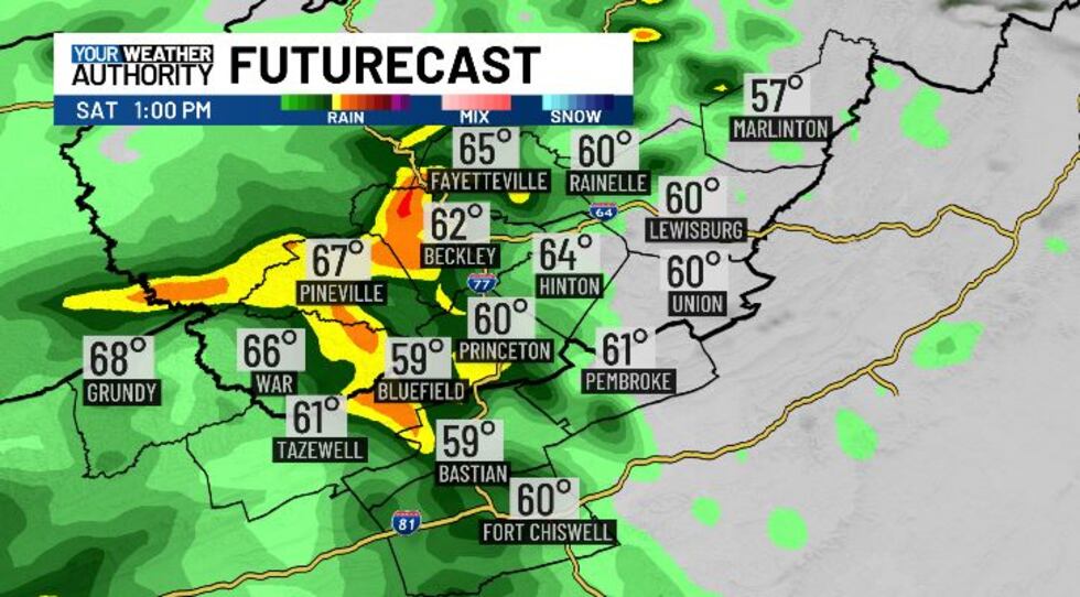
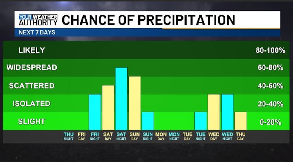
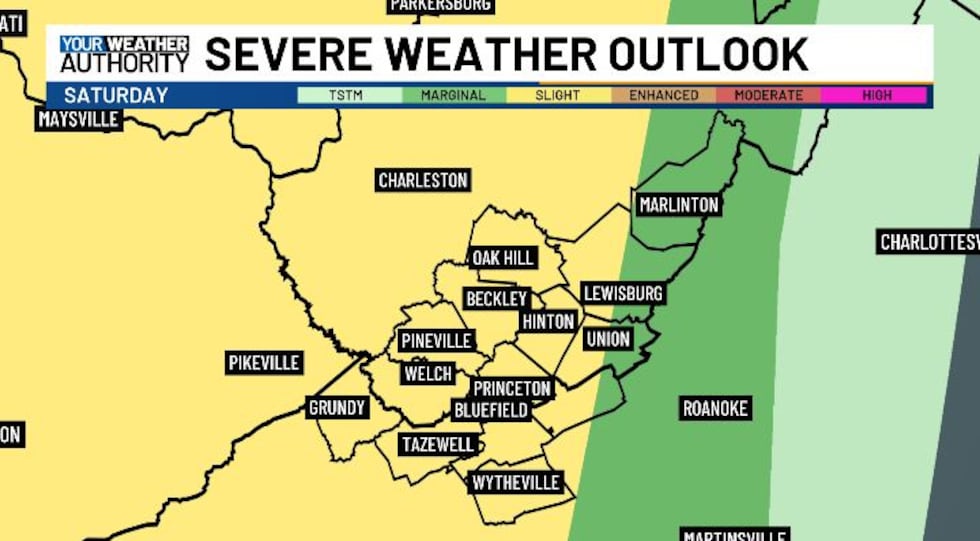
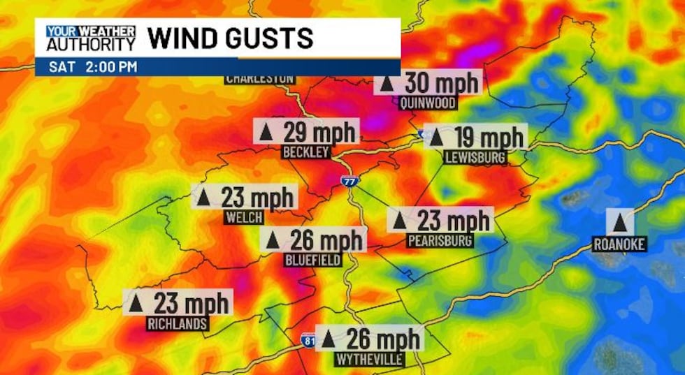
Saturday will bring on and off rain and thunderstorms (mainly during the afternoon and evening) as a cold front moves into the area. Highs will top off again around the 70 degree mark, and some storms Saturday could be strong to severe. We’ll otherwise be windy in general, with gusts in the 50-60 MPH range possible Saturday night-Sunday AM. Sporadic power loss/downed trees cannot be ruled out.
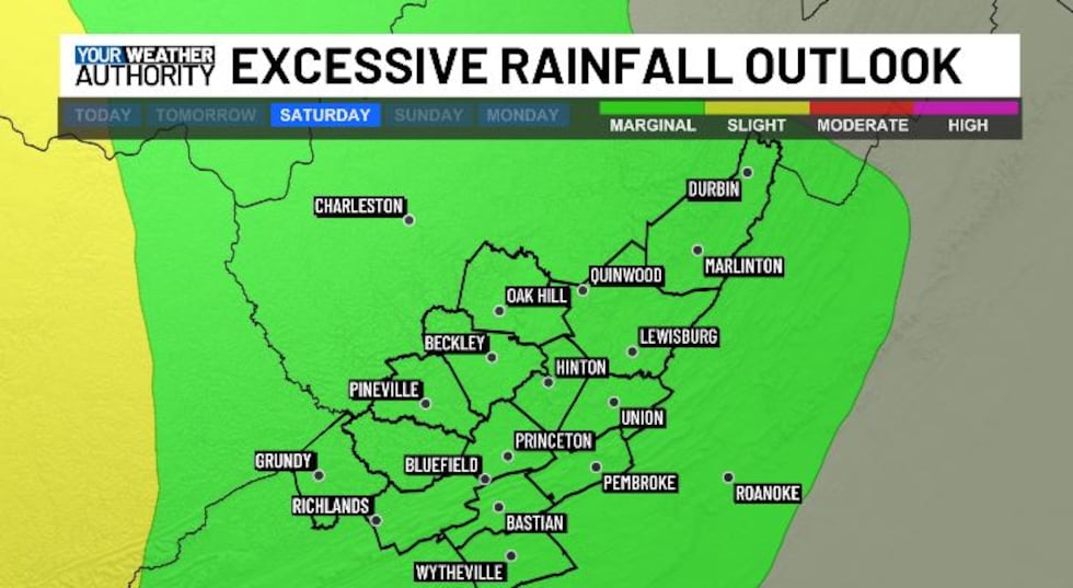
Our area is also in a risk for excessive rainfall through the weekend. Isolated flooding could result thanks to localized heavier bands of rain through Saturday and Sunday.
Temps will stay warm through Sunday, then drop behind the front into the 30s Sunday night as winds whip out of the NW.
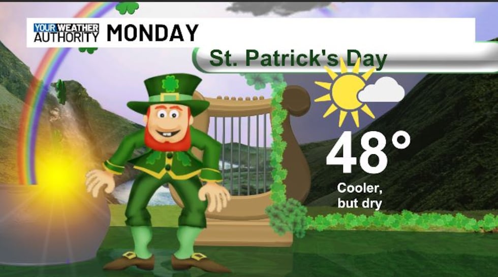
We look cool but dry on St. Patrick’s Day, with highs in the 40s and plenty of sunshine.
We warm up again next week.....STAY TUNED!
Copyright 2025 WVVA. All rights reserved.


