One last day of sunny and warm weather today, as severe weather looms on the horizon
Stay weather aware tomorrow night.
This Pi Day we’re going to see a good amount of sunshine this morning, with temperatures climbing into the upper 50s pretty quickly. This afternoon’s temperatures will be reaching up into the upper 60s and low 70s once again. A very similar temperature profile to the last two days. A few more clouds roll in this afternoon.

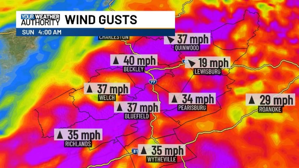
Winds will pick up today, coming from the south at 5-10 mph. Gusts of up to 25 mph will be possible. We’ll see gusts increase up to 30 mph tomorrow morning, and overnight tomorrow and into Sunday, wind gusts of up to 40 mph will be possible with this cold front.
This front is what’s going to bring us the chance for some severe weather tomorrow. The greatest chance for damaging storms will be well to our south, but most of our area is under a slight risk. We’re looking at an initial batch of storms during the morning on Saturday, and more storms could end up limiting storm potential for the evening. If that’s the case, we could see a lowered risk. If we don’t however, and instability stays high, we could see an upgrade to our severe risk. Main threats will be damaging winds and large hail, but we’re also not ruling out the possibility for some flooding.
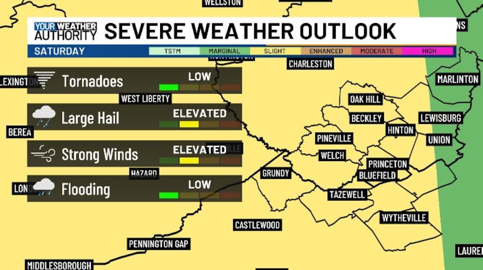
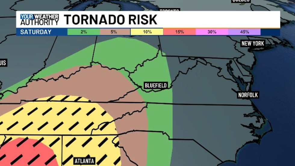
We’re also looking at an increased tornado risk for tomorrow, with most of our area under a 2% risk, with parts of Buchanan County under a 5% risk, right on our doorstep. Make sure to stay weather aware and have a way to get weather alerts Saturday night just in case.
Saturday morning the storms will be very popcorn-like in nature, so most of us will stay dry. Around 1 - 2 PM we’ll see the thunderstorms popping up to our west in Kentucky, and we’ll see a few showers here ahead of it. Widespread rain moves in after 5 PM, with strong thunderstorms out behind it. After 10 PM looks to be the time frame for when the severe weather will be possible, so this will be an overnight event. Make sure to have your phone charge and the ringer loud enough to where it will wake you up if an urgent alert is issued.
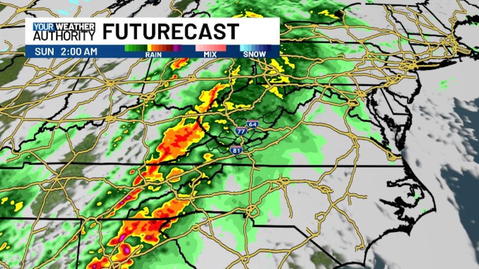
Storms will continue to push through into early Sunday morning, with some leftover showers possible through the rest of Sunday. Next week is trending drier in the first half, with us looking a lot cooler on St Patrick’s Day. We’ll be back in the 60s and 70s through the middle of next week.
Copyright 2025 WVVA. All rights reserved.


