Showers and thunderstorms possible Saturday, with the chance for a few strong to severe storms Saturday night
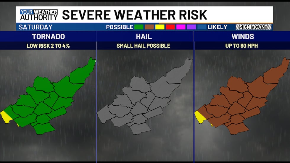
Severe weather threat from overnight Saturday into Sunday morning
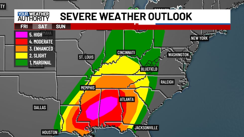
A strong storm system will sweep across the South on Saturday afternoon, producing severe thunderstorms with damaging winds, large hail, and tornadoes. As these storms push north and east toward our region, uncertainty remains about how much instability will be present when the line of severe storms arrives.
As of Friday afternoon, the Storm Prediction Center has downgraded our region to a Level 1 severe weather risk due to this uncertainty. However, continue monitoring the latest updates in case the weather situation changes over the next 24 to 36 hours.
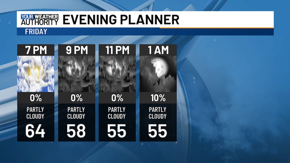
In the short term, clouds will increase tonight, but dry conditions should persist. Lows will drop into the 50s, with breezy southeast winds at 10 to 15 mph and gusts reaching up to 25 mph.
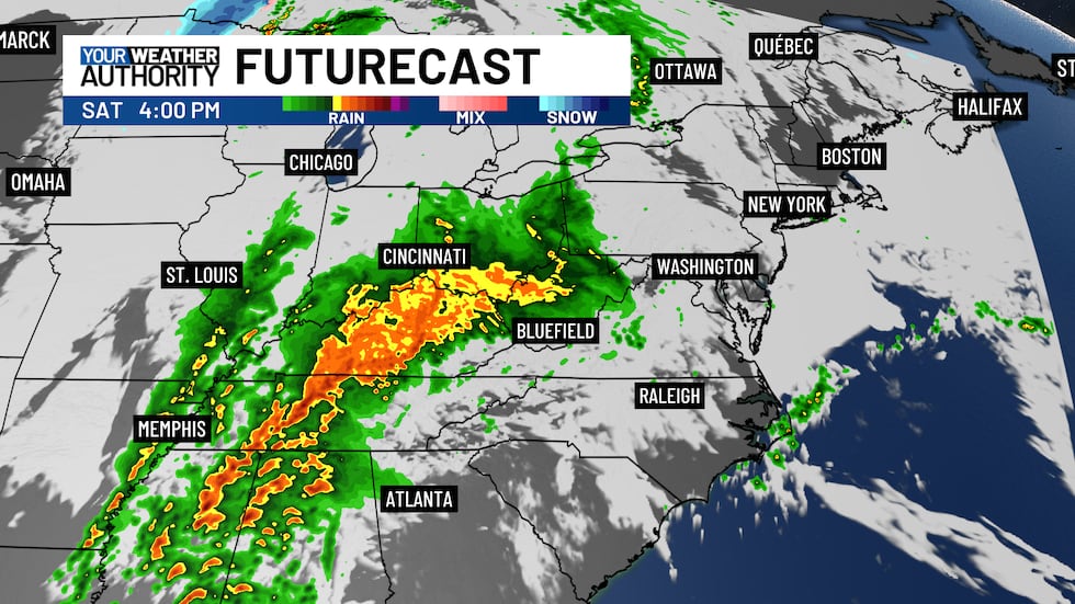
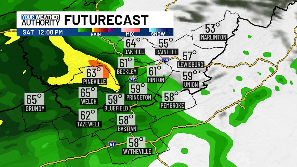
On Saturday, showers and thunderstorms could develop as early as mid to late morning. While a few storms may produce strong, damaging winds, most should remain non-severe.
These morning storms will be key in determining the potential for severe weather later, as they could use up some of the available energy. However, if a lull in activity occurs, allowing sunshine to break through the clouds, the atmosphere could recharge—something to watch closely.
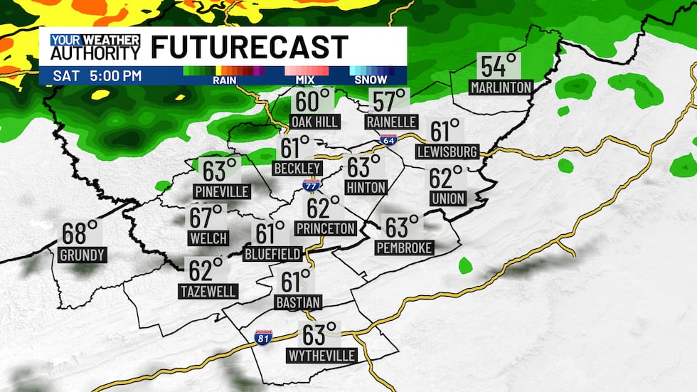
The greatest chance for severe storms will likely arrive during the overnight hours into mid-morning Sunday. Damaging winds appear to be the primary threat, but a quick tornado spin-up remains possible.
That line of storms will move through by Sunday morning, though scattered showers and storms could linger throughout the day. Stay weather aware!
Copyright 2025 WVVA. All rights reserved.


