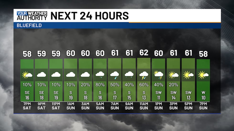
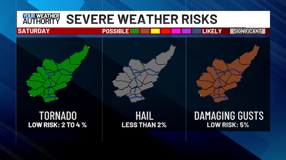
Still this evening, the chance for strong to severe storms will occur after 3AM tonight
Storms likely moving in after 3AM, with the threat for strong to severe storms from 5AM to Noon Sunday
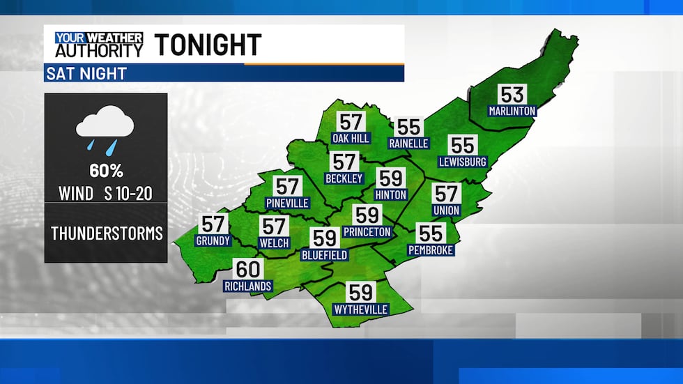
No weather concerns this evening as dry conditions will persist under partly to mostly cloudy skies. Temperatures will hold steady in the 50s and 60s through the evening and into the night.
After 3 AM, rain and thunderstorms will begin moving in from west to east, bringing the potential for severe storms.
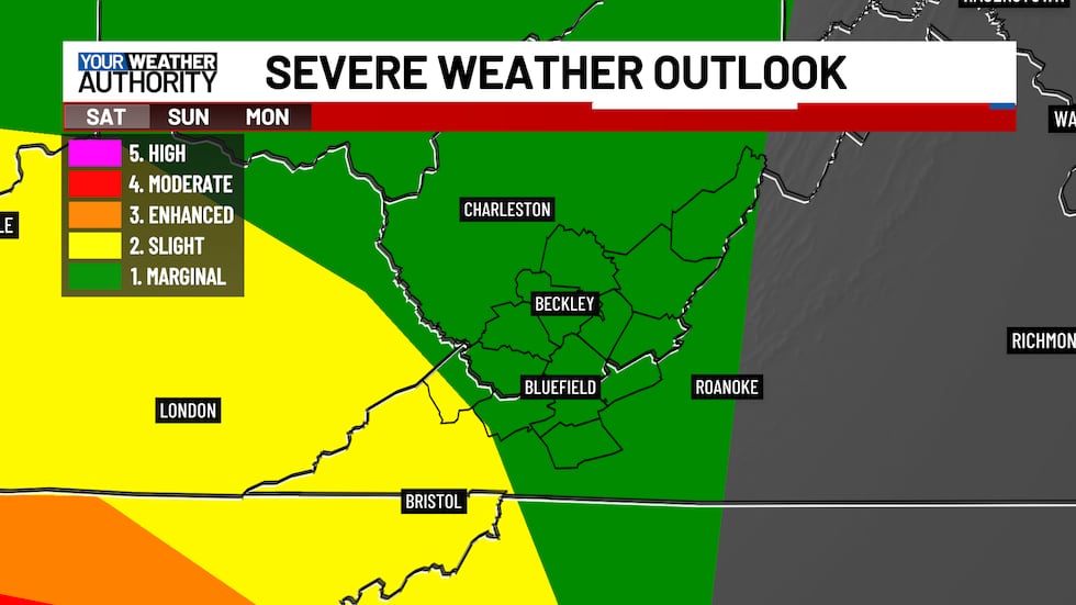
The severe weather outlook keeps our area under a marginal risk for the overnight hours through 8 AM Sunday.
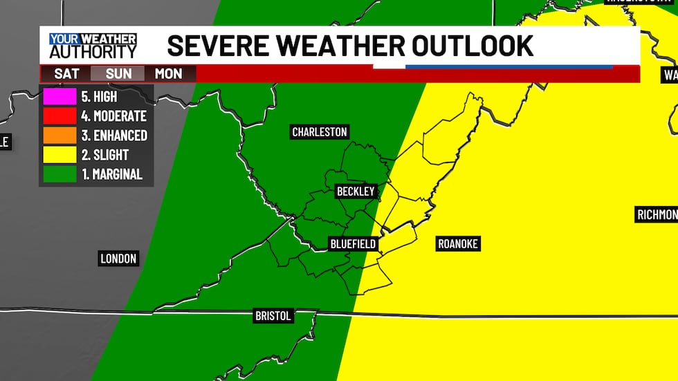
For Sunday, a marginal risk remains for most of our region, while a slight risk covers our eastern counties, mainly from the morning into the early afternoon. Additional storm development could occur in the afternoon, and we will monitor any severe potential within those cells.
Damaging wind gusts and a quick tornado spin-up remain the primary threats late tonight into Sunday morning.
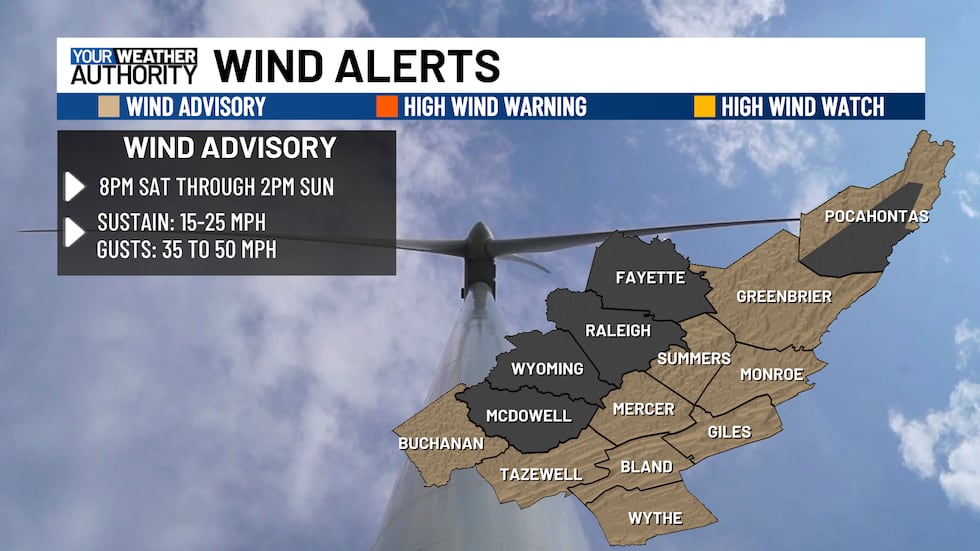
Regardless, if your location sees a severe thunderstorm or not, it will still be windy regardless. Wind advisories have been issued for portions of our viewing area.
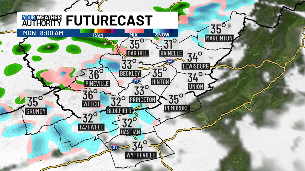
Colder air will move in on Monday, bringing the possibility of a few snow showers or flurries in the morning. However, with temperatures near or above freezing, no accumulation is expected.
Copyright 2025 WVVA. All rights reserved.


