Below average temperatures today, but sunshine returns later this afternoon
Temperatures could drop a few degrees below freezing tonight.
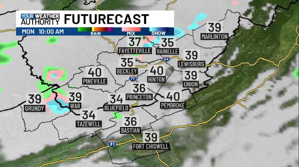
Temperatures this morning are coming in in the upper 30s and low 40s. Yesterday we saw temperatures cap out at 66 degrees right at lunchtime, but they quickly dropped by 10 degrees as thunderstorms rolled through the area. On radar we have overcast skies to start out our week, with a few stray showers popping up outside our area.
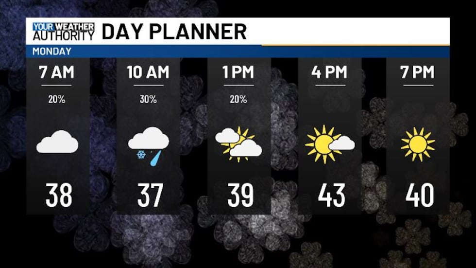
This morning some of us could see a pop-up shower, with the chance for some light flakes instead if temps are cold enough. Most of these occur around 10 AM. After lunchtime the clouds will taper off pretty quickly as high pressure builds in, giving us lots more sunshine into the afternoon. Overnight will be clear and quiet, with lows dropping a few degrees below freezing. If you’ve started planting your garden a bit early, make sure to take steps to protect your outdoor plants. Tomorrow will bring us mostly sunny skies and high temperatures topping off in the mid 60s. Winds will be a bit breezy and gusty today, coming from the northwest at 10-20 mph, with gusts up to 30 mph.
Today will be the coolest day we’ve seen in a while, with temps topping off in the mid and low 40s. Temperatures this morning start out similar, but we cool down into the mid 30s by 10 AM. Temps recover into the afternoon. Tomorrow and Wednesday will bring our temperatures back into the 60s, and even the mid 70s on Wednesday.
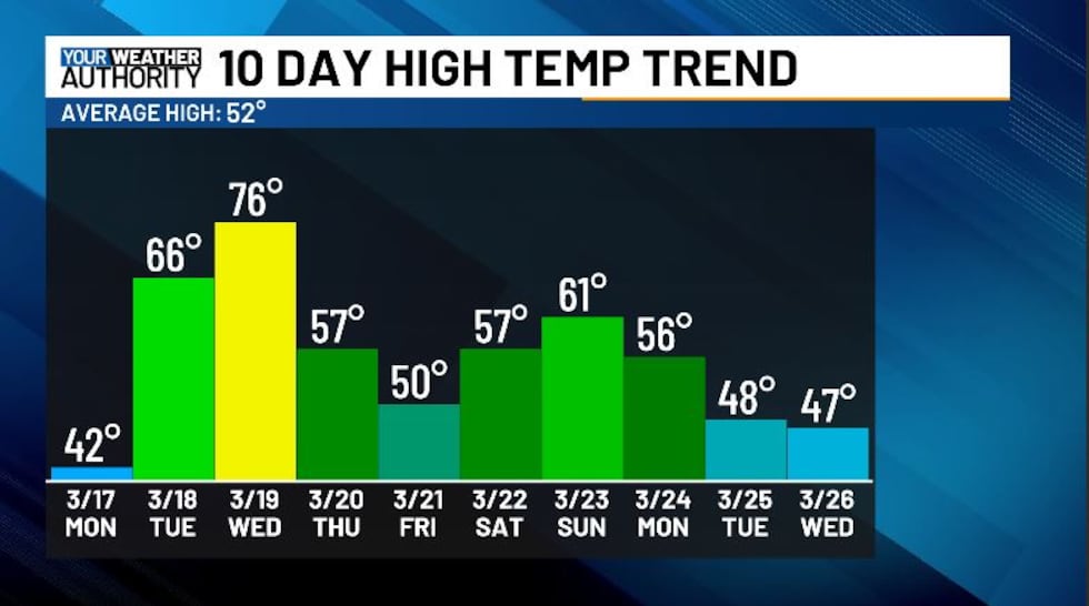
Wednesday’s high temperatures are going to reach into the mid 70s, likely taking over as the warmest day most of us have seen so far this year. Thursday is the first day of spring, with rain and falling temperatures thanks to a passing cold front.
Copyright 2025 WVVA. All rights reserved.


